


West Michigan has enjoyed balmy temperatures the last 48 hours, but the bottom is about to drop out on the thermometer Thursday night.
FOX 17 has issued a Weather Ready Alert for Friday morning as a Flash Freeze and Snow Showers create hazardous morning commute. Lake effect snow showers and blowing snow in lakeshore countiesGusty winds could create blowing snow and reduced visibility, and any lingering standing water or ice will freeze and become slick.
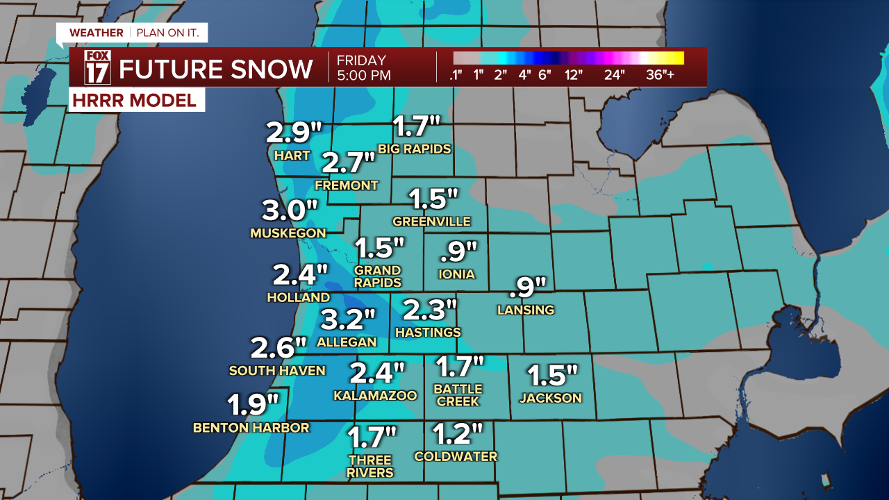
There is a WINTER WEATHER ADVISORY for the lakeshore and Kalamazoo County from now until 1 p.m. Friday. Snow totals will be highest from aroung Muskegon to South Haven at 2-4", with around an inch of snow expected elsewhere.
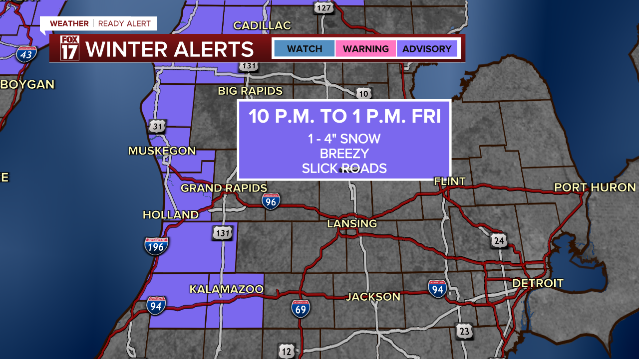
As the low pressure system sweeps in on Thursday night we'll see it bring in cold air and start up lake effect snow bands. The flakes will start to fly around 10 p.m., with more widespread snow arriving overnight and early Friday morning.

Snow intensifies and expands along the lakeshore overnight, leading to snow covered roads and wind-driven snow by bus stop and commute time Friday morning.

Snow will be tapering down in the early afternoon as the core of the low pressure system moves away from West Michigan.
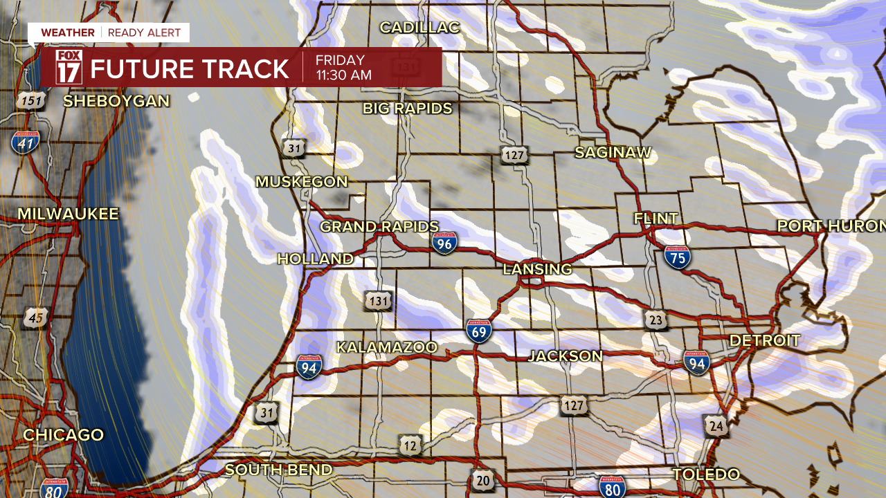
While snow totals will be highest along the lakeshore, there will be slick spots and snow-covered roads possible across West Michigan. Low visibility from blowing snow is also likely at times.
The more widespread issue will be a freeze of any standing water. With the recent melting of our snow pack, there are many roads that could turn to ice overnight, making Friday morning's commute difficult.
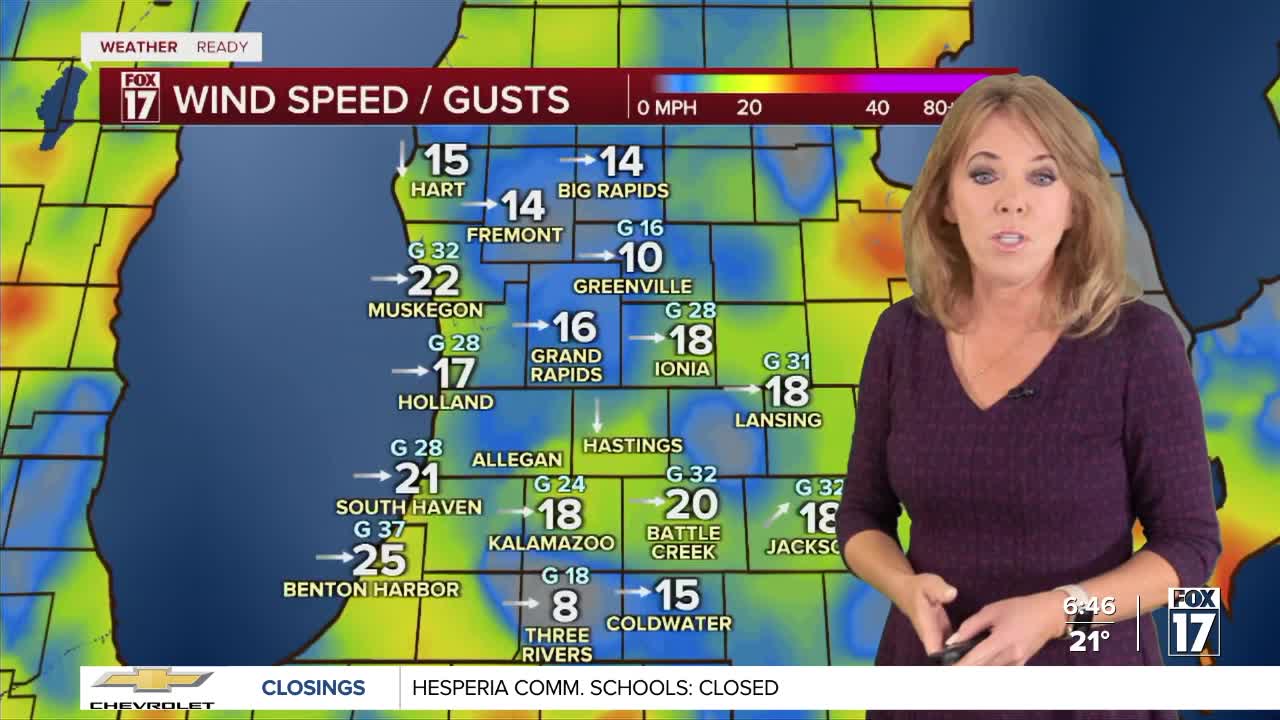
With a high temperature in the mid-twenties and winds up to 25 miles per hour, feels like temperatures will be in the single digits on Friday. Be sure to bundle up!

For the latest details on the weather in West Michigan, head to the FOX 17 Weather page.
Follow FOX 17: Facebook - X (formerly Twitter) - Instagram - YouTube
