


Friday, March 6 is a FOX 17 Weather Ready Alert Day due to the risk for a few strong thunderstorms Friday evening into Saturday morning.
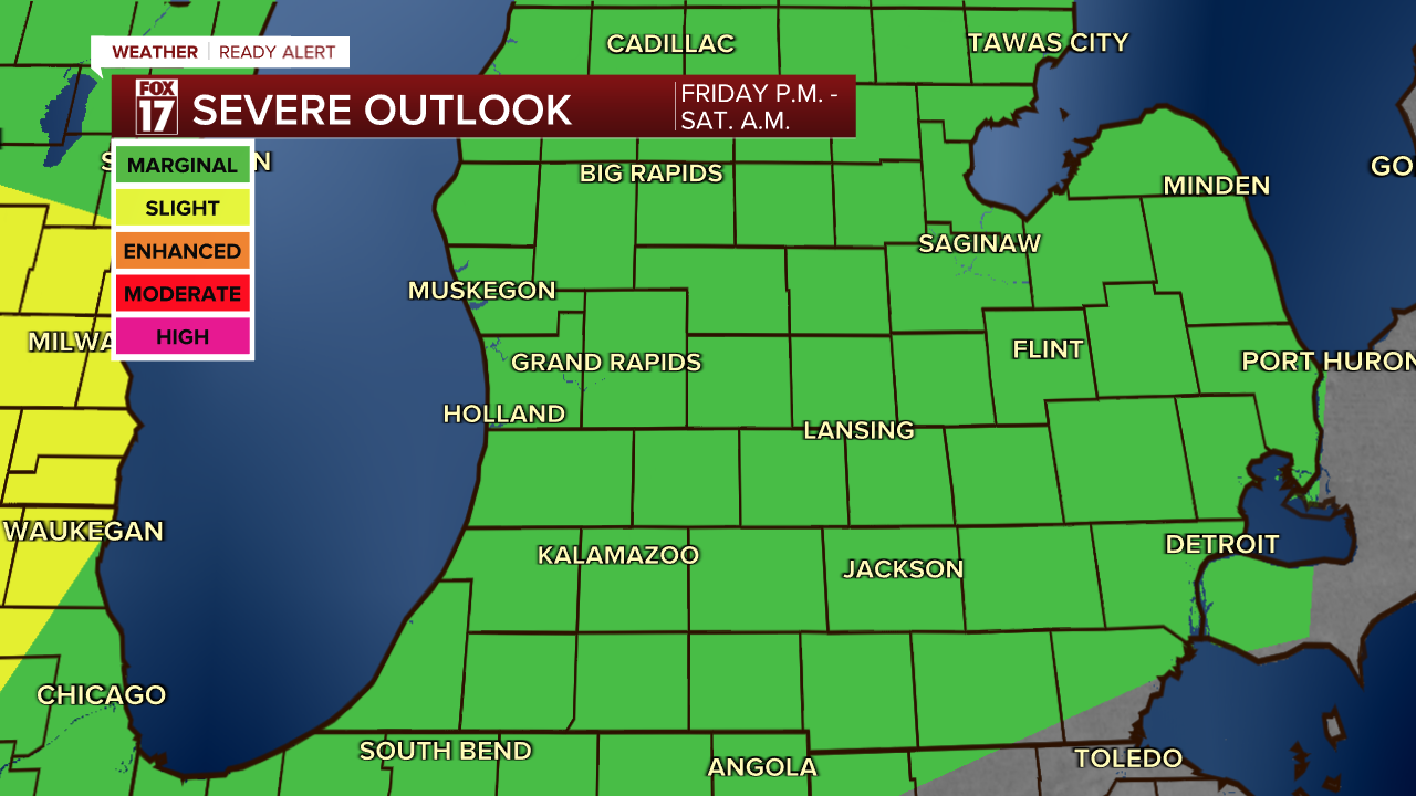
The image tied to this story is the severe weather outlook for the Storm Prediction Center. All of Lower Michigan remains in a MARGINAL threat (level 1 out of 5) for strong/severe storms.
Hail up to one inch in diameter, wind gusts of 60 mph, and even an isolated tornado cannot be ruled out.

Most locations should see a widespread half inch to one inch of rain, but depending on where the storms set up, they could "train" over the same areas and some locations could see 1" to 2" before this system moves out. See image below of our four most popular forecast models showing total rainfall through Saturday.

Wind will also be a factor on Saturday. We expect brisk southwest to west winds at 15 to 25 mph with gusts of 35/40 mph. See image below valid for 6 A.M. Saturday. Winds will remain prevalent all day Saturday as temperatures gradually fall into the 50s from morning highs in the mid 60s.

This is our first chance of severe weather this season. so make you have a way to obtain watches, warnings, and advisories.
For the latest details on the weather in West Michigan, head to the FOX 17 Weather page.
Follow FOX 17: Facebook - X (formerly Twitter) - Instagram - YouTube
