


WEST MICHIGAN — The Spring warm-up continues through Thursday, with temperatures soaring into the 60s. An incoming cold front crashing into that warm air Thursday afternoon and evening brings the chance for a few isolated strong to severe thunderstorms, along with widespread rain.
The primary risk area for severe storms is to our south in the yellow Slight Risk (level 2 out of 5), but West Michigan is included in the green Marginal Risk (level 1 out of 5) for a few storms that could become strong or briefly severe.
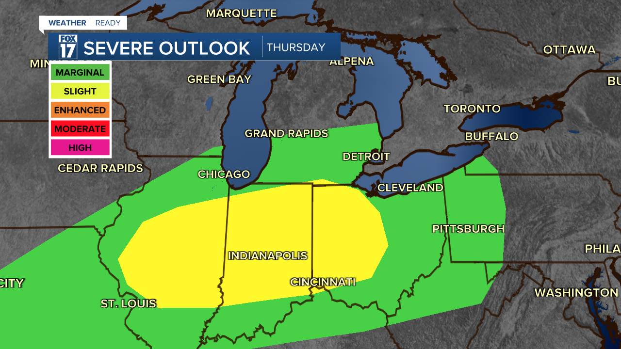
Damaging winds 60 mph or higher, and hail larger than quarters are the primary concerns as of now for any storms that develop. An isolated spin-up tornado can't be ruled out, but this is a secondary threat at the moment.

Most of the early part of the day will be dry, but rain will start building in the afternoon as the cold front gets closer. A few gusty storms are possible especially south of I-94.
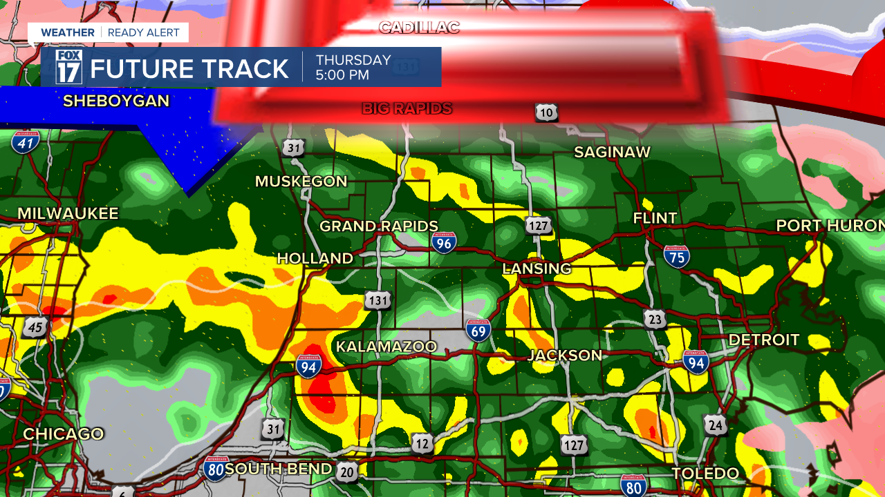
Pockets of heavy rain could lead to brief ponding on the roads in low lying spots, too. Combined with the evening commute, this will likely lead to slowdowns. Rain totals will be anywhere from half an inch along and north of I-96 to an inch or more near I-94.
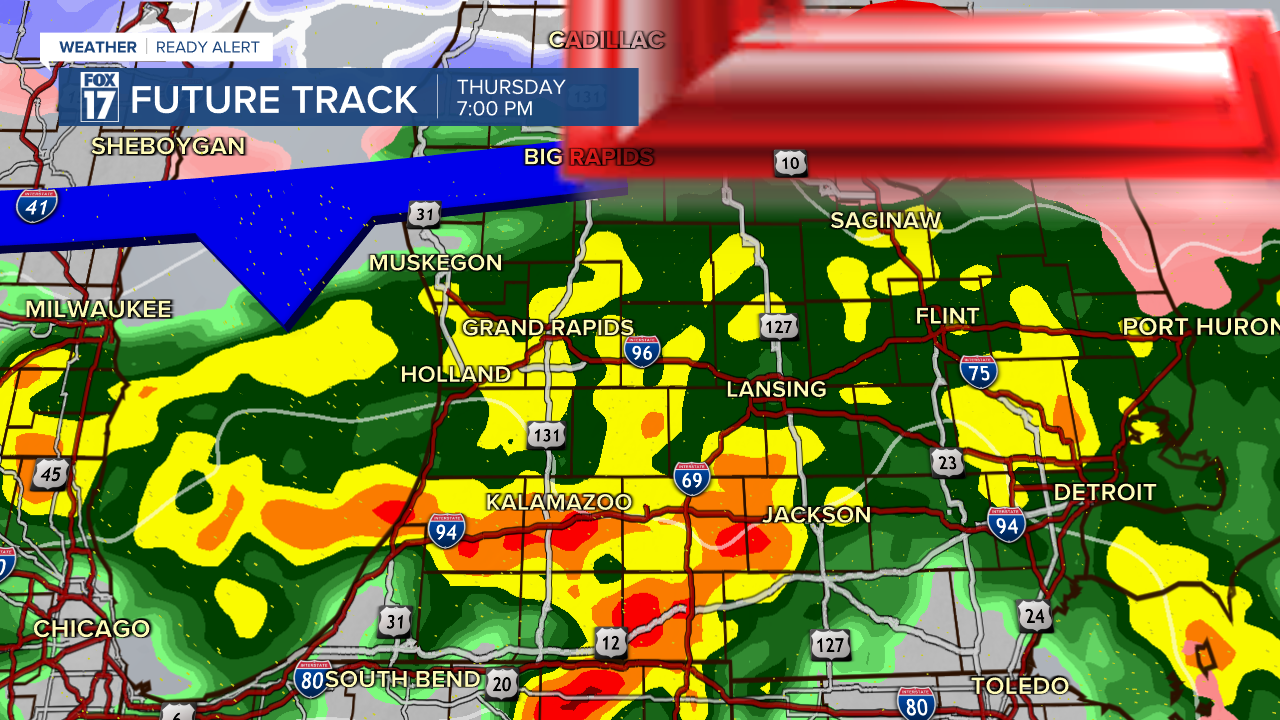
Waves of rain and storms continue to move through West Michigan into the evening. Damaging wind gusts of 50-60 mph are possible briefly within the strongest storms.
By the late evening heavy rain is still ongoing, and a few stronger storms embedded within the rain could produce gusty winds from I-94 to the Indiana state line.
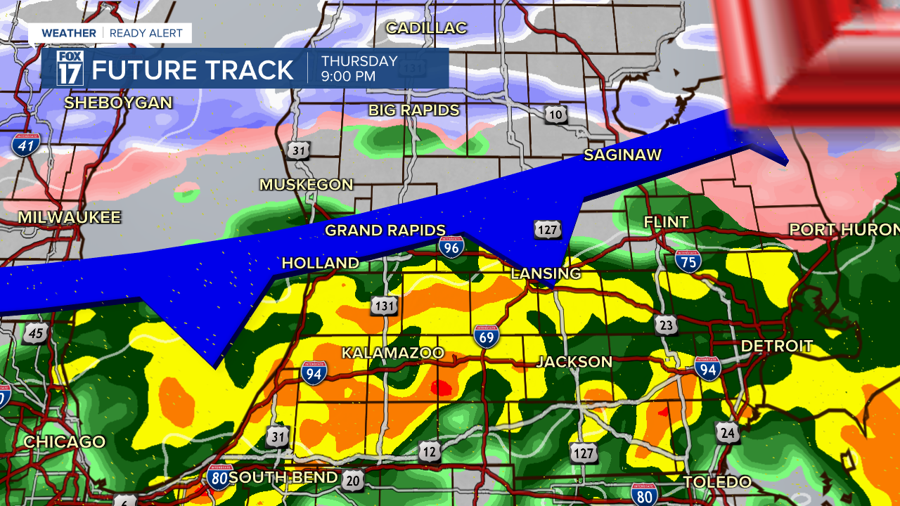
By midnight, the rain and storm threat is over and colder air will be swinging in to West Michigan for the start of our Friday. You'll need a winter coat Friday morning again as temperatures plunge into the 20s.
For the latest details on the weather in West Michigan, head to the FOX 17 Weather page.
Follow FOX 17: Facebook - X (formerly Twitter) - Instagram - YouTube
