WEST MICHIGAN — After a 'green' Christmas in West Michigan, many of us are looking forward to snow. The chance of light snow and cooler air is not far away!
When will cooler air return?
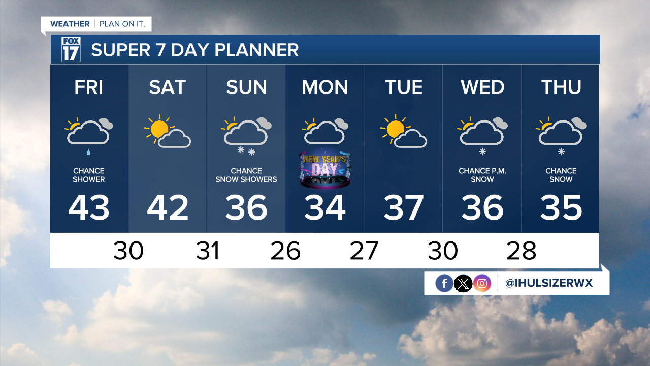
The latest forecast models show closer to 'normal' temperatures returning by the beginning of the New Year. Our average high temperature for this time of year is 33 degrees. Sunday is New Year's Eve and Monday is New Year's Day.

The coolest air will arrive after Saturday, with high temperatures back in the 30s. While it is sill above-average for this time of year, we'll be closer to normal.
When will snow make a comeback?
The FOX 17 Weather Team has been tracking a change in our weather pattern by this weekend. Forecast models have been fluctuating in the timing and amount of snow, but all models can agree on the return of cooler air.

Extended models show the best chance of snow on Sunday. A system is expected to arrive early Sunday morning, approaching from the northwest.
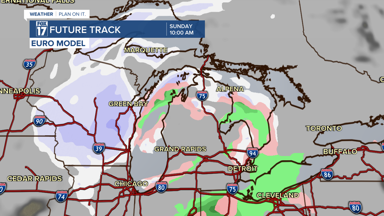
Snow will become widespread by Sunday afternoon and overnight. Although most of the precipitation will be snow, some light rain is possible at times.

As a reminder, Sunday is New Year's Eve. You'll want to take your time traveling on Sunday as roads could be slick at times. Overnight low temperatures will dive below the freezing point. A few flurries are possible on Monday. All-in-all, this will be a weak system.
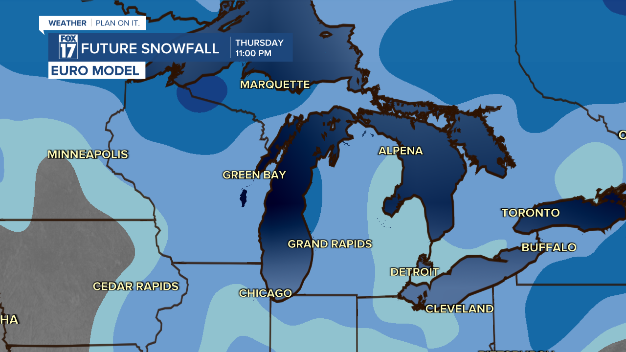
Another chance of light snow creeps into West Michigan late Wednesday.

Snow will progress overnight Wednesday and into early Thursday. Again, this will be a weak system that arrives from the northwest. Minor accumulation is possible.

Where will the snow accumulate?
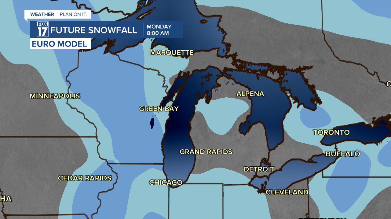
The most recent forecast trends are indicating limited accumulation in West Michigan over the next few days. Below is a forecast for how much snow we'll receive by 8 a.m. Monday. West Michigan could see up to one inch of snow with Sunday's system.
More snow will track in on Wednesday and Thursday. This will give a better opportunity for accumulating snow! As of now, the best chance for accumulation will be along and towards the west of U.S. 131.
Stay tuned with FOX 17 News for your most updated forecast. You can always download the FOX 17 Weather App.