


WEST MICHIGAN — After rounds of heat starting in Late June, lasting through Mid-August, we've finally turned the corner into the end of Meteorological Summer.
Afternoon highs over the next week look to peak only in the lower 80s. Even more relieving is the low humidity coming with it. Dew points look to range between the low 50s and low 60s in the long term.

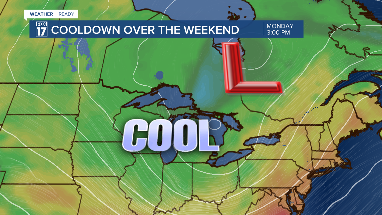
This pattern for West Michigan is influenced by 2 cut off lows across the broader region.
First, Hurricane Erin is trudging along the Atlantic, just grazing the Carolina coastline with the outer bands. Meanwhile, another cut off low is developing in south central Canada, and is forecast to peak when over Lake Superior.

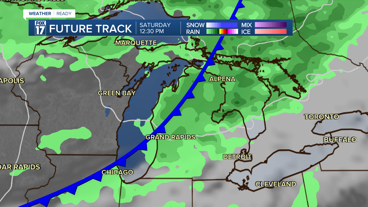
These 2 systems combined with allow for a narrow and weaker band of warmth between the two on Friday, with the cold front moving into West Michigan Saturday, we will see some light rain from the front, but the focus for moisture is after the front.
Sunday, afternoon highs will only reach the low to mid 70s, while Monday seems likely to be stuck in the upper 60s most of the day. Upper air mass temperatures will be even colder, and with water temps in the 70s, pair up for a lake effect event in the end of August.
Lake Effect rain isn't uncommon in West Michigan. Lake Effect happens anytime we see a temperature difference of 13°C or more between water temps and upper air temps. allowing for the transfer of the moisture into West Michigan from a northwest flow.
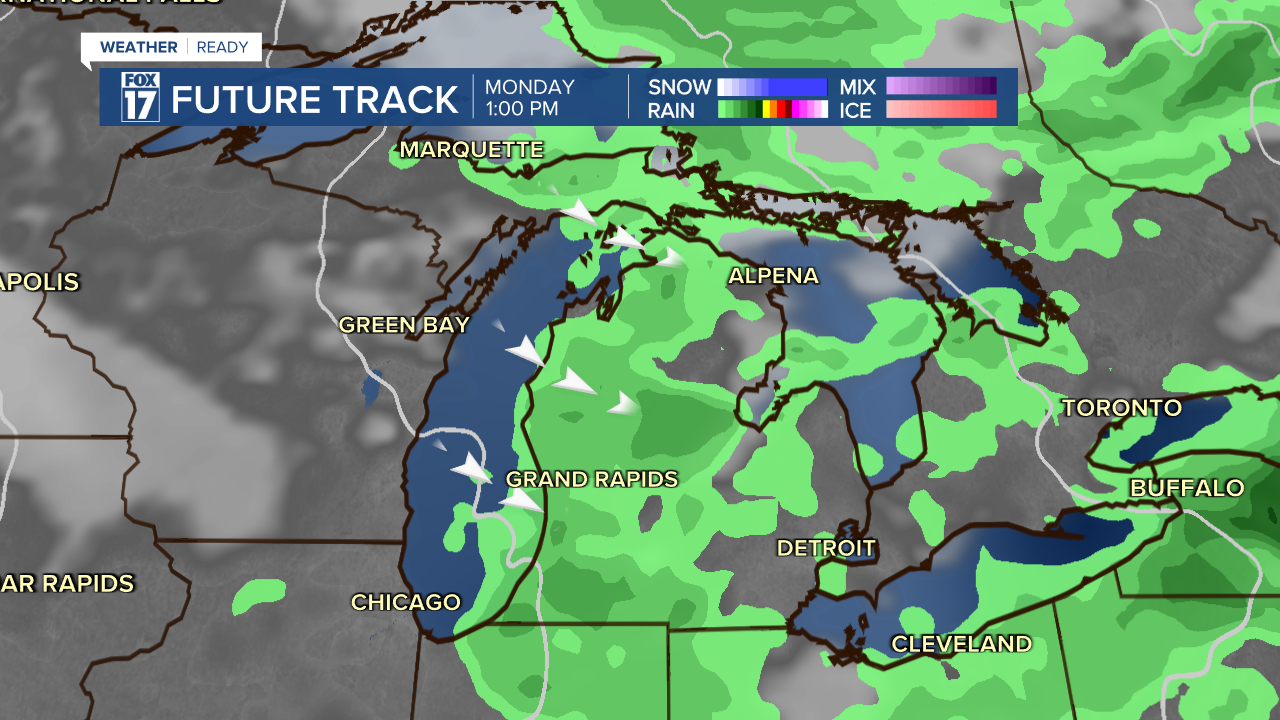
This is most common with snowfall in the Winter, but when we get a big enough cool down in the late summer and early Fall, we get a reminder of why West Michigan's weather is so unique.

For the latest details on the weather in West Michigan, head to the FOX 17 Weather page.
Follow FOX 17: Facebook - X (formerly Twitter) - Instagram - YouTube
