


WEST MICHIGAN — For the first time since July 30 - 31, Grand Rapids recorded a 2-day rainfall total over 1"!
Here's a look at this weekends rainfall reports at the five main reporting sites in West Michigan. On the right side, is the updated rainfall deficit/surplus for each city since January 1.

Significant rain still continues to focus itself along I-94, but everywhere, except far northwestern communities, seeing over an inch of rain calls for a small sigh of relief.
Is this a one-off system? No, the tides are turning.
Tuesday - Thursday this week have a system moving into West Michigan. This will provide widespread rainfall, while driving in cool air with a strong breeze.

A cut off low is over Minnesota Monday. This will shift east overnight and provide a line of showers ahead of a cold front.
Once the front passes Tuesday morning, we will wait for wrap around cooler air to move over Lake Michigan. This will fire off lake enhanced rain with a strong West wind.
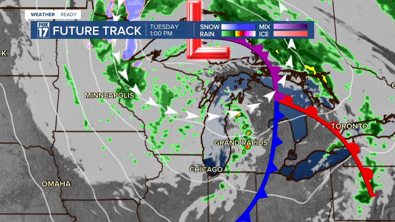
We may even see some thunderstorms in the initial lake enhanced bands Tuesday afternoon and evening.
Into Wednesday, the air mass gets even colder, allowing for Lake Effect rain, meaning mostly areas along and west of U.S.-131 Wednesday morning. As the wind picks up midday, inland areas will see more rain.

Expect western communities to see well over an inch of rain, with local spots seeing 2"+. Inland areas will see between .5" and 1"!

For the latest details on the weather in West Michigan, head to the FOX 17 Weather page.
Follow FOX 17: Facebook - X (formerly Twitter) - Instagram - YouTube
