

It's almost the start of astronomical summer, and we have had see-saw temperatures for much of May and June across West Michigan. It looks like this week, ahead of the Summer Solstice on June 20, temperatures stay consistently warm and some of us will make a run at 90 degrees! This would be the first 90 degree day of the year.
The first 90 degree day in Grand Rapids is, on average, June 18. This is factoring in all temperature data since 1896 when records started being consistently kept.

Last year, the first 90 degree day was June 17. The first 90 degree day has been as late as August 11 though, back in 1907!
In Kalamazoo, the average first 90 degree day is June 15. Last year, it was June 13.
Muskegon's average first 90 degree day is quite a bit later, July 3. Last year it was June 16. There are 42 years in Muskegon's history that did not hit 90 degrees or higher though, which does skew the data.
Even though most major cities in West Michigan hit 90 for the first time in mid to late June, the average high temperature for mid-June is around 80 degrees. So hitting 90 in mid-June means temperatures are running about 10 degrees above average!
The best opportunity to hit 90 degrees this week will be Sunday, with an outside chance on Saturday as well. A strong high pressure building in will push down on the air, heating it up and along with ample sunshine temperatures will soar into the upper 80s and for some, the low 90s.

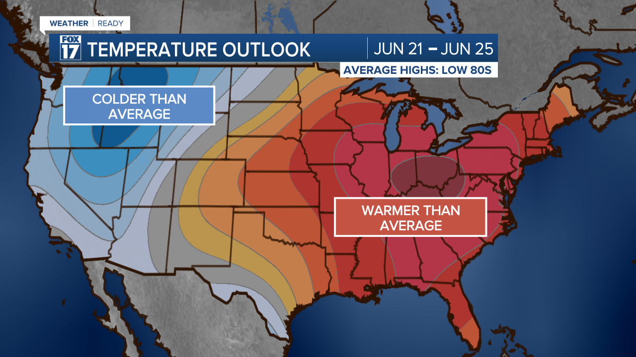
The medium-range forecast hints at continued warm weather, with high confidence of above average temperatures for the eastern 2/3 of the country through June 25. For us here in West Michigan, average temperatures during that time are in the low to mid 80s.
For the latest details on the weather in West Michigan, head to the FOX 17 Weather page.
Follow FOX 17: Facebook - X (formerly Twitter) - Instagram - YouTube
