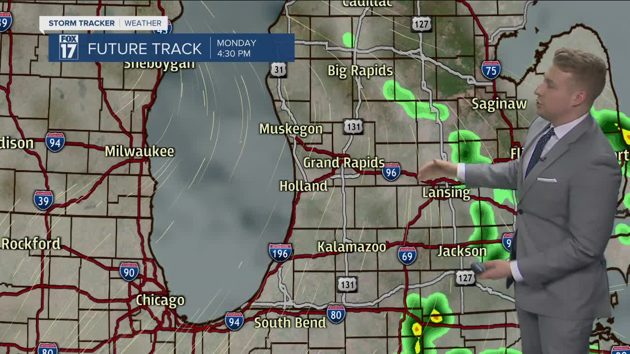


WEST MICHIGAN — After wonderful weather this Sunday, you will be dodging raindrops all of next week. Several rain and even storm chances will dot the map Monday-Friday.
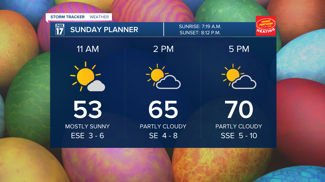
Today will be the best day to get outside this week with the sunshine and warmth! Temperatures today will make it to around 70° with also lighter winds compared to Saturday.
Once we head into the work week, a warm front will develop in the area, bringing more moisture our way. This will lead to a few waves of energy moving along the front as it hangs around the area, leading to the rain chances Monday and Tuesday. It will not rain the entire day on any day this week, but you will want to have the umbrella handy. Thunder will also be possible as there will be enough moisture and warmth to support the chance.
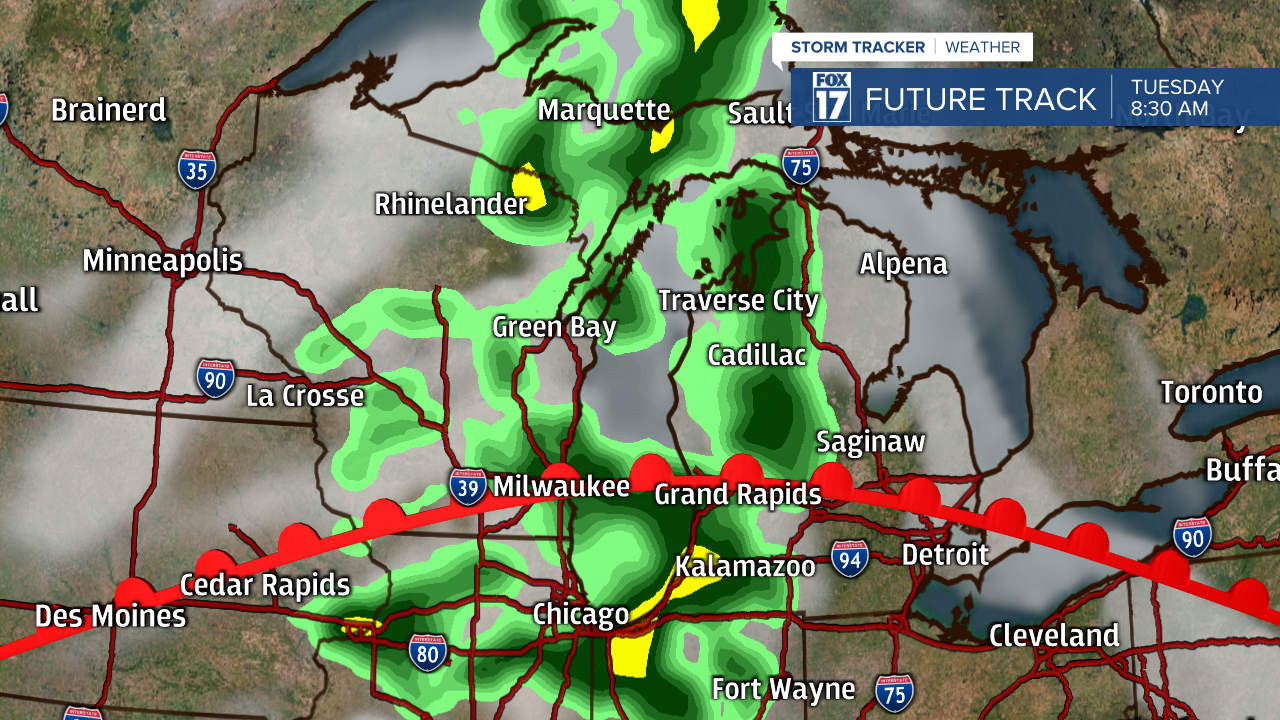
A much better shot at rainfall and heavier downpours will be Wednesday-Friday as a stronger/slower low-pressure heads our way. A few rumbles of thunder will also be possible in this activity. Thankfully, this system will not pull in significantly colder air, so we are going to stay in the 50s and 60s during the rainier days.

Rainfall Monday-Friday will likely make it to around 1", although up to 2" is not out of the question. This will be perfect to help elevate the dry conditions that have been with us the last several weeks. Also good news with this system, there will be no severe weather on any of the days. Drier weather will return next weekend!