


The forecast from FOX 17 Weather Ready Meteorologist Kara James: Watch for some patchy fog the next few mornings, especially east of U.S.-131. The "mid-summer" re-run across West Michigan continues for the next several days, as a huge area of high pressure brings loads of sunshine and unseasonably warm air into the region. Our "average" highs for mid-September are in the mid-70s, and Wednesday and Thursday will be in the mid to upper 80s! While it will be warm, humidity is expected to stay low and in check the next few days. Watch for our drought conditions to worsen in the week ahead. Our next rain chance isn't likely until this weekend, and even that won't be a slam dunk for all. Make sure to stay up to date with the FOX 17 Weather Ready Team for your latest forecast updates.

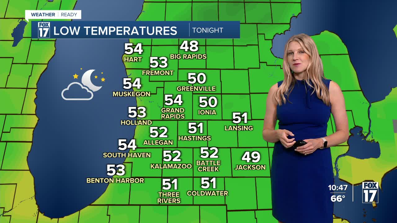
TONIGHT: Clear and comfortable. Lows in the mid 50s. Winds light.
WEDNESDAY: Sunny, warm, and pleasant. Highs in the mid 80s. Winds southeast/northwest at 5 to 10 mph.
THURSDAY: Mostly sunny and warm. Highs in the mid 80s.
FRIDAY: Mostly sunny to partly cloudy and cooler. Highs in the lower 80s.
SATURDAY: Partly cloudy. Slight chance of a shower. Highs in the upper 70s.
SUNDAY: Partly sunny to mostly cloudy. Chance of showers, perhaps a thundershower. Highs in the mid/upper 70s.
MONDAY (FALL EQUINOX): Partly sunny, chance of showers. Highs in the upper 70s.
TUESDAY: Mostly sunny with chance of showers. Highs in the mid-70s.
For the latest details on the weather in West Michigan, head to the FOX 17 Weather page.
Follow FOX 17: Facebook - X (formerly Twitter) - Instagram - YouTube
