
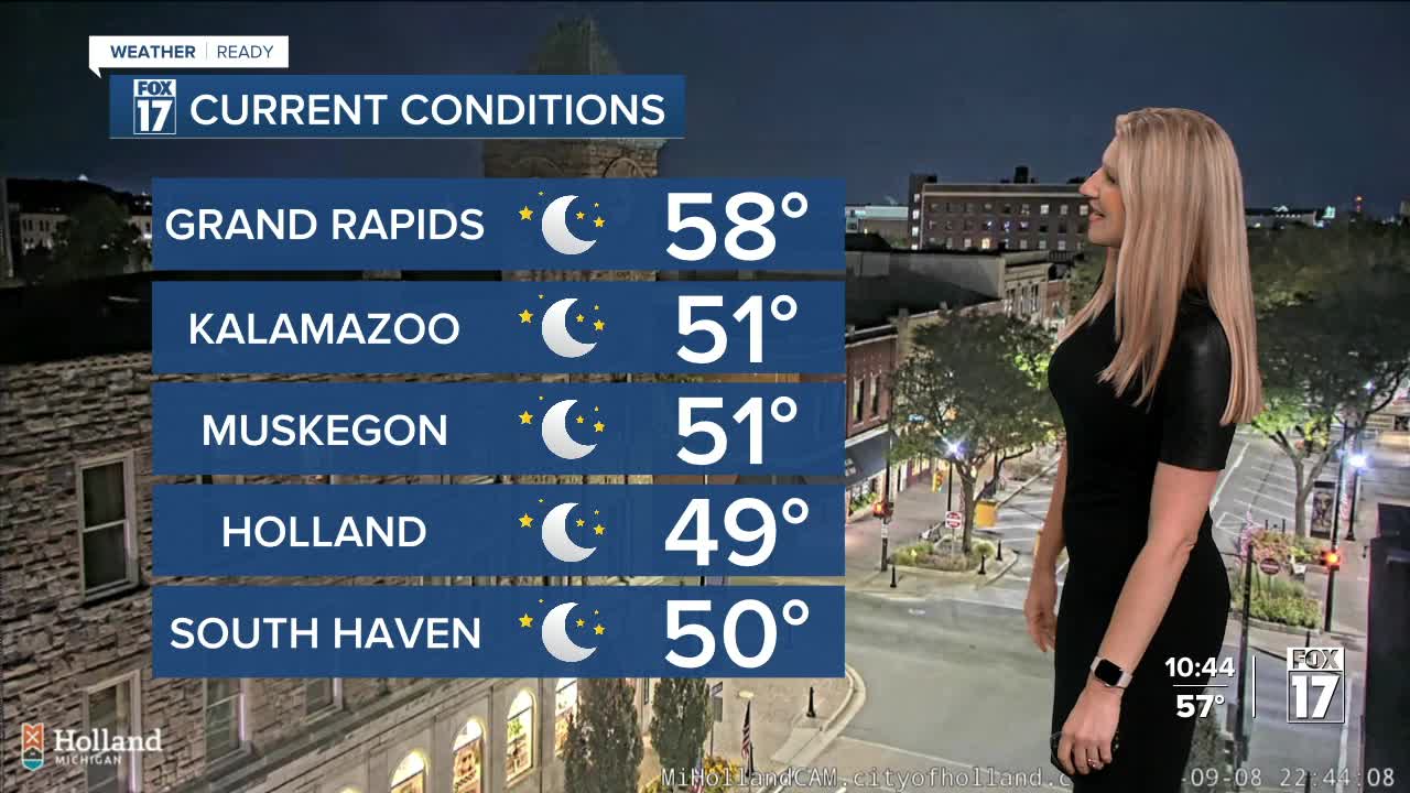


The forecast from FOX 17 Weather Ready Meteorologist Kara James: We woke up to temperatures in the upper 30s north of I-96 for the first time since June 2nd! This is the last of the October-like chill for the week, with warmer temperatures and mainly dry weather expected this week. Tomorrow through the rest of the work week temperatures climb into the middle to upper 70s, with several days in the 80s likely toward the end of the week and weekend! This comes as a big ridge of high pressure nudges out of the 4 Corners region into the Midwest, flipping our pattern to dry, sunny and warm days. Rain chances are near zero area wide this week, with our next chance coming this weekend as an upper low drops in from Canada. Timing and location of the rain is still uncertain, so stay tuned to the FOX 17 Weather Ready Team for your latest forecast updates.
TUESDAY: Partly cloudy and pleasant. A bit breezy. Highs in the mid 70s.
WEDNESDAY: Mostly sunny and warmer with highs in the upper 70s.
THURSDAY: Sunny skies with highs near 80.
FRIDAY: Mostly Sunny. Pleasant. Highs in the low 80s.
SATURDAY: Partly cloudy with the chance of a few showers. Highs around 80.
SUNDAY: Partly cloudy with isolated showers possible. Highs in the upper 70s.
MONDAY: Partly cloudy, with highs in the middle to upper 70s.
For the latest details on the weather in West Michigan, head to the FOX 17 Weather page.
Follow FOX 17: Facebook - X (formerly Twitter) - Instagram - YouTube
