
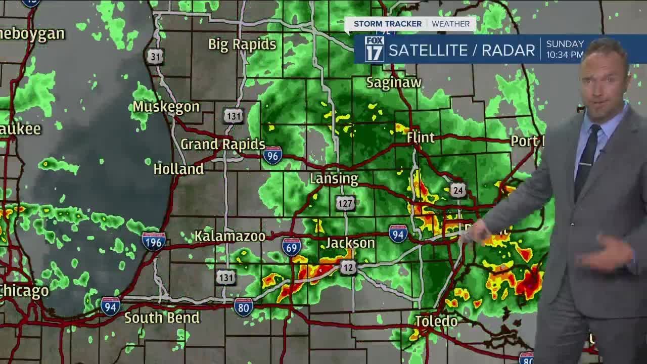


WEST MICHIGAN — The forecast from FOX 17 Meteorologist Anthony Domol: Plan on an active weather evening. Nearly all of West Michigan falls under a slight risk for severe weather, with locations along and south of I-96 under an enhanced risk. All types of severe weather are possible, but damaging winds are the greatest concern. An isolated tornado can't be ruled out south of I-96. Showers & storms will exit the region around daybreak Monday and most of Monday thereafter will be rain-free. By Monday night it is dry, clear and cool with lows expected to drop into the 40s. With the cold air aloft, there will be a fair amount of cloud development on Tuesday afternoon. High temperatures only reach the upper 60s to lower 70s. Temperatures quickly trend up by the end of the work week.
Also...Summer arrives (officially) at 11:32 p.m. Sunday night. It marks the longest day of the year with more than 15 hours and 20 minutes of daylight. This might be the best gift for dad, seeing that Sunday is Father's Day!
TONIGHT: Showers and storms this evening and overnight with strong to severe potential. Overnight lows in the mid 60s.
TOMORROW/MONDAY: Mostly cloudy with a few showers and storms during the early morning. Temps in the 60s.
TUESDAY: Partly sunny and cool with highs near 70.
WEDNESDAY: Partly sunny. An afternoon sprinkle/shower possible. Highs in the mid 70s.
THURSDAY: Partly cloudy with highs in the low to mid 80s.
FRIDAY: Mostly cloudy with the chance for showers and storms. Highs in the mid 70s.
For the latest details on the weather in West Michigan, head to the FOX 17 Weather page.
