


From Fox 17 Weather Ready Meteorologist Kara James: Any remaining snow will fade away overnight behind a cold front, as clouds gradually clear and temperatures plunge. Roads will continue to be very slick in spots overnight, especially bridges, overpasses and neighborhood and rural roads. Temperatures will plunge close to single digits overnight as an Arctic high slides in. With any small breeze, feels like temperatures could drop to near 0 in spots. Thursday will be mostly sunny but very cold with highs in the low 20s. Friday morning will once again be close to single digits, with highs in the mid 20s. The overall pattern remains unseasonably cold and intermittently active, with more light snow Friday night into Saturday midday, and another system Monday night into Tuesday.
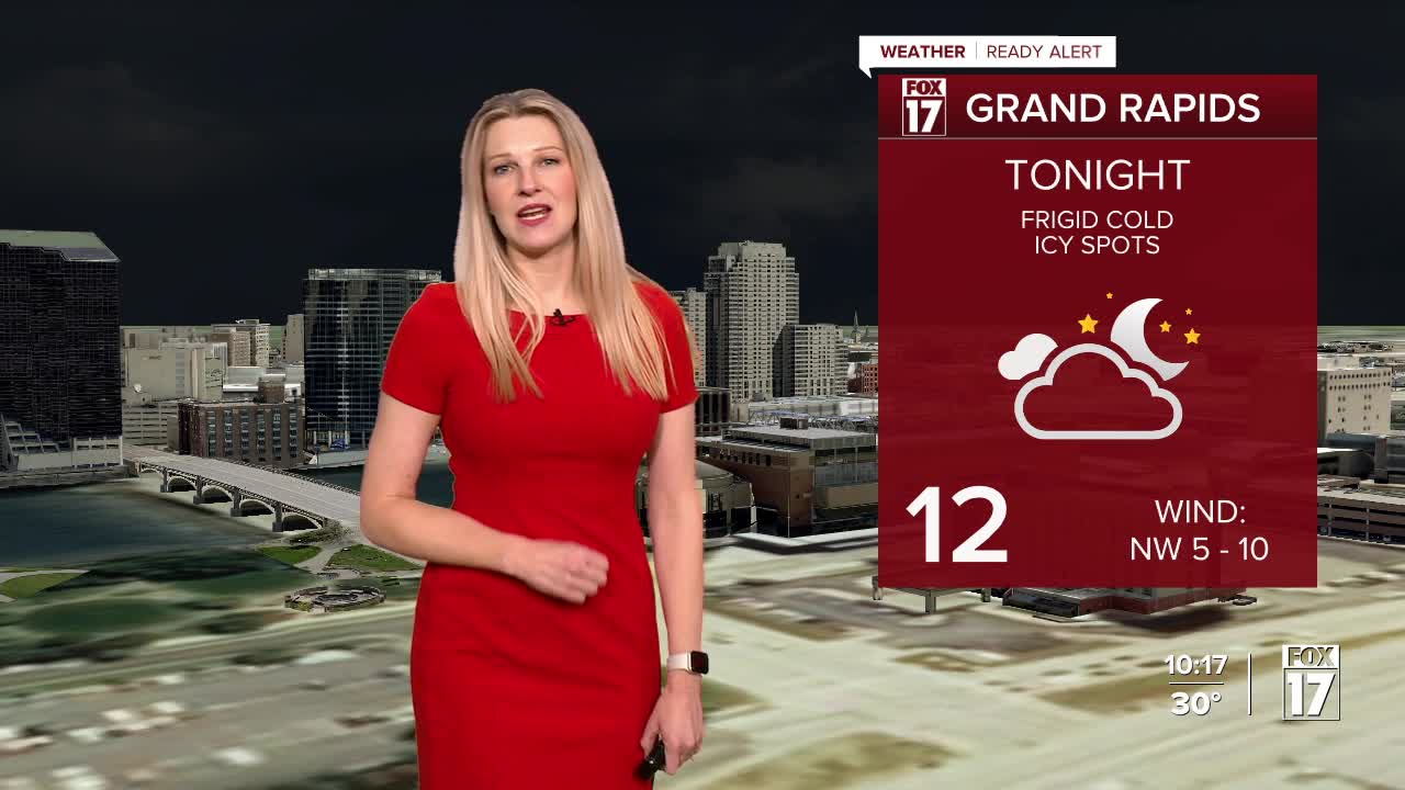
TONIGHT: Mostly cloudy with lows in the low to middle teens. Winds: NW 5-10 mph
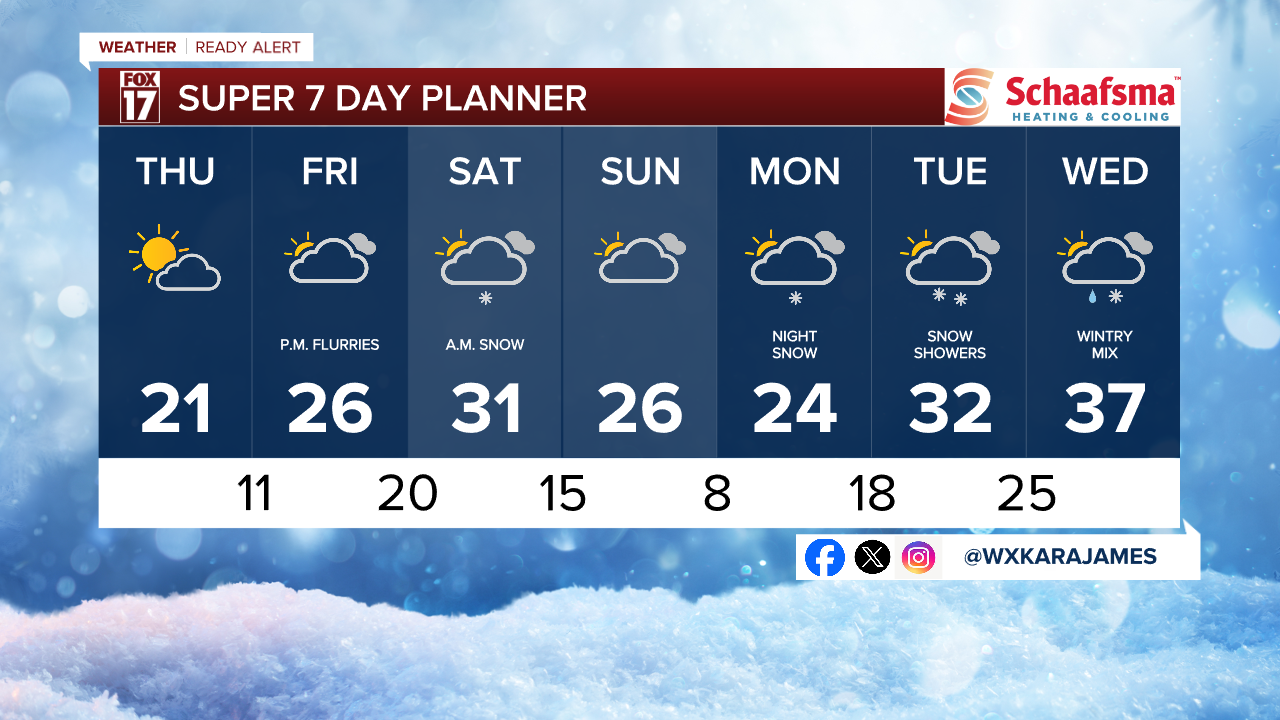
THURSDAY: Sharply colder with partial sunshine. Highs in the low-20s.
FRIDAY: Mostly Cloudy and cold. Highs in the mid-20s.
SATURDAY: Chance snow. Highs in the low 30s.
SUNDAY: Chance few snow showers. Highs near 30-degrees.
MONDAY: Cloudy early with afternoon and evening snow showers. Highs in the upper 20s.
TUESDAY: Mostly cloudy with snow likely. Highs in the low 30s.
WEDNESDAY: Wintry mix likely with rain and slushy snow. highs in the mid to upper 30s.
For the latest details on the weather in West Michigan, head to the FOX 17 Weather page.
Follow FOX 17: Facebook - X (formerly Twitter) - Instagram - YouTube
