


WEST MICHIGAN — The forecast from FOX 17 Meteorologist Ty Shesky: Low pressure will move across northern Michigan overnight into Friday morning, dragging a cold front through. This front will bring another round of rain with embedded thunderstorms overnight into early Friday. After the front clears the area, look for increasing sunshine on Friday along with seasonably warm temperatures to begin the weekend.
TONIGHT: Cloudy with showers and thunderstorms likely. Some storms could produce locally heavy rainfall. Lows in the upper 50s. Winds south/southwest at 5 to 15.
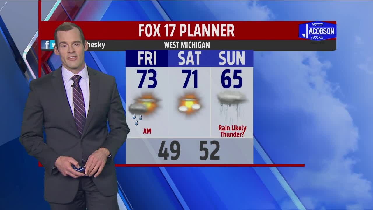
TOMORROW: A chance of early morning showers/t'storms, then becoming partly cloudy. Highs in the lower 70s. Winds west to northwest at 8 to 15 mph.
TOMORROW NIGHT: Partly cloudy. Cooler with lows in the upper 40s to near 50. Northwest winds at 5 to 10 mph becoming northeasterly overnight.
SATURDAY: Partly cloudy and pleasant. Highs in the lower 70s. East/northeast winds at 8 to 16 mph.
SUNDAY: Mostly cloudy. Showers likely, possibly a few thunderstorms. Highs in the middle 60s.
