
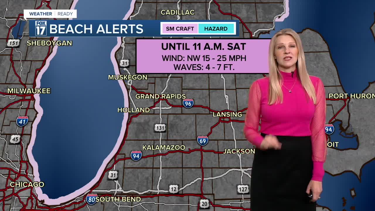


The forecast from FOX 17 Weather Ready Meteorologist Kara James: It will be partly to mostly cloudy behind the cold front and cool overnight with lows in the mid-40s. A SMALL CRAFT ADVISORY is in effect through Saturday at 11 a.m. for waves 4-7 feet and breezy northwest winds. Saturday will be near average, with a mix of sun and clouds and highs in the mid-60s. Sunday will be in the upper 60s with temperatures early next week back into the 70s, above average once again. Isolated rain chances are possible late next week, but are far from a slam dunk. Drought conditions will continue to worsen. Stay with the FOX 17 Weather Ready Team for your latest forecast updates.
TONIGHT: Partly cloudy, Winds relax after midnight. Lows: Mid-40s. Winds: N 5-10 mph
SATURDAY: Slight chance isolated morning shower. Some morning cloudiness, otherwise mostly sunny. Highs in the mid 60s. Winds: N-NE 5-15 mph
SUNDAY: Mostly sunny and pleasant. Highs in the upper 60s to near 70.
MONDAY: Mostly sunny with highs around 70.
TUESDAY: Mostly sunny with highs around 70.
WEDNESDAY: Partly cloudy with highs in the upper 60s.
THURSDAY: Partly cloudy with highs in the mid 60s.
FRIDAY: Partly Cloudy. Highs in the low-60s.
For the latest details on the weather in West Michigan, head to the FOX 17 Weather page.
Follow FOX 17: Facebook - X (formerly Twitter) - Instagram - YouTube
