


The forecast from FOX 17 Weather Ready Meteorologist Reece Cole: Heat relief finally arrived with a low pressure system, providing clouds, scattered showers, and thunderstorms. The air conditioners finally get a break for the second half of the week with much lower humidity and highs slipping into the upper 70s and low 80s. Overnight lows the next several days will be comfortable in the 50s and 60s. In fact, a beautiful stretch of weather is in store Thursday through Sunday. Enjoy! We may be able to start seeing the Perseid Meteors in the coming days, but they don't peak until August 12/13. This is an annual event and stems from debris from the tail of the comet Swift Tuttle. Stay tuned to the FOX 17 Weather Ready Team for your latest forecast updates.
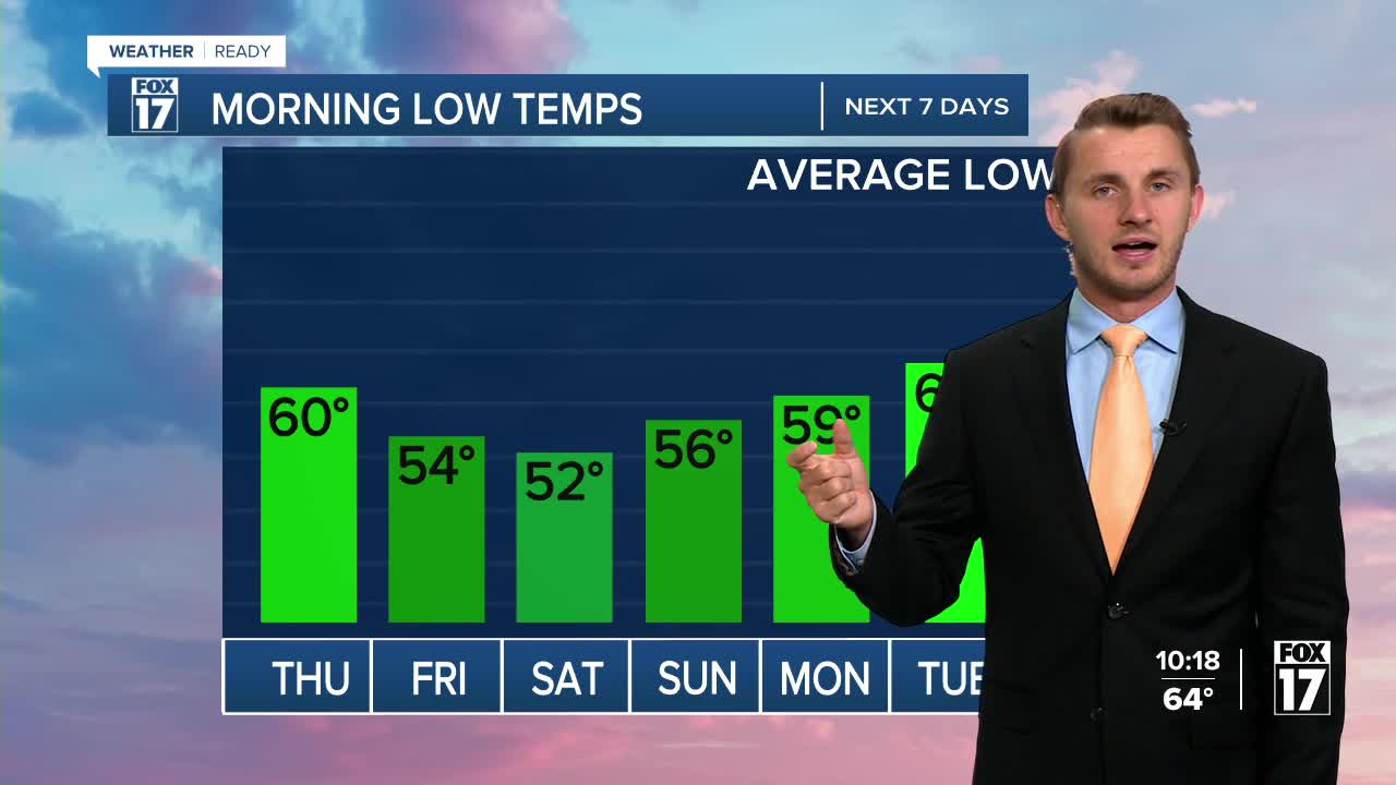
TONIGHT: Cloudy with rain showers, perhaps a few rumbles of thunder. The steadiest rain and heaviest accumulations are likely south of Grand Rapids. Lows around 60. Winds northeast at 5 to 10 mph.
THURSDAY: Morning clouds...perhaps a few lingering showers, otherwise gradual afternoon clearing. Cooler and less humid. Highs in the upper 70s. Winds northeast at 5 to 15 mph.
FRIDAY: Mostly sunny and pleasant. Highs in the upper 70s.
SATURDAY: Mostly sunny. Highs in the low 80s.
SUNDAY: Mostly. Highs in the lower 80s.
MONDAY: Partly cloudy and warmer. Chance of an isolated shower/storm. Highs in the mid 80s.
For the latest details on the weather in West Michigan, head to the FOX 17 Weather page.
Follow FOX 17: Facebook - X (formerly Twitter) - Instagram - YouTube
