
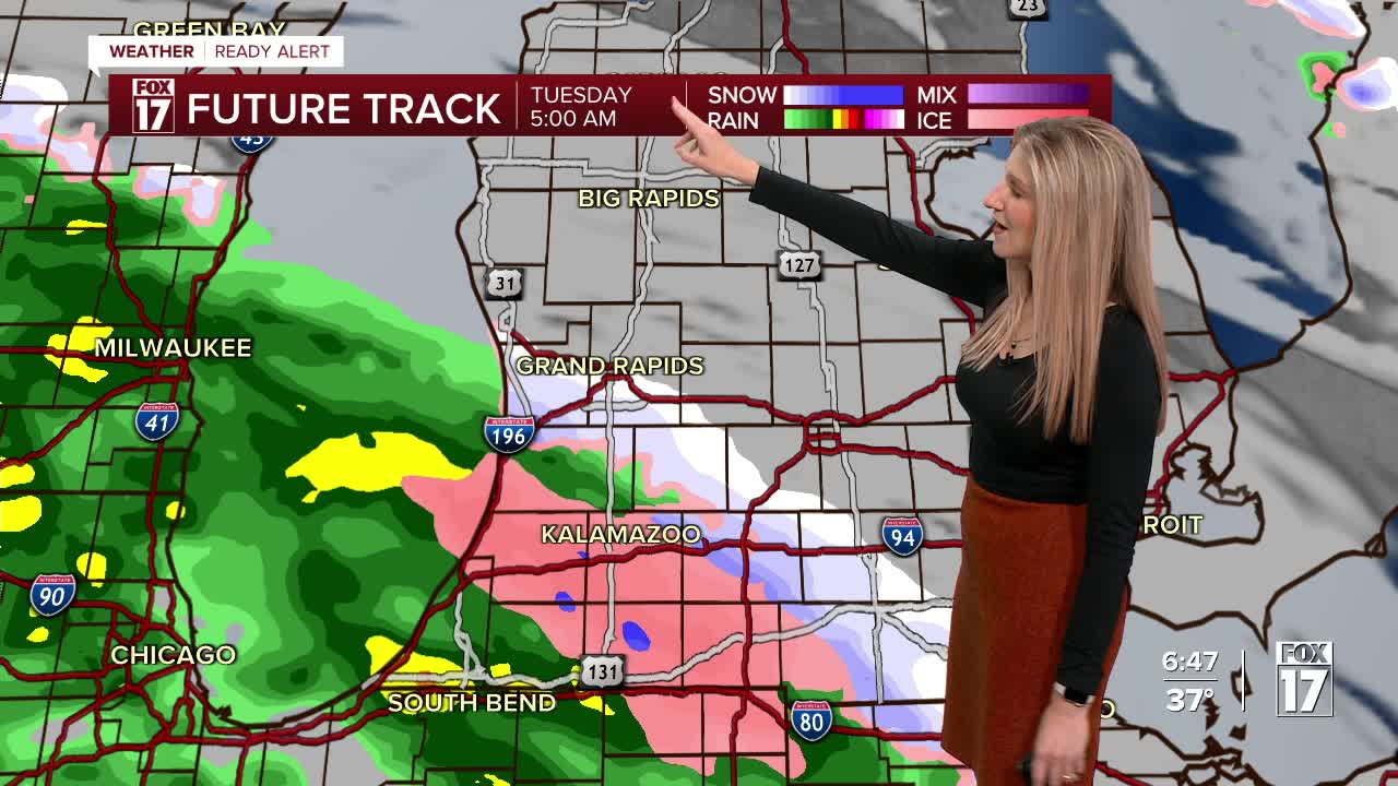


WEST MICHIGAN — The forecast from FOX 17 Meteorologist Kara James: A system passing to our south overnight and drawing in some cold air brings a wintry mixture of rain and snow after 3 a.m., continuing through the day Tuesday. A WEATHER READY ALERT has been issued for this wintry weather. Light snow is more likely north of I-96, but even there accumulations will be low, less than 1". The impacts for the wintry mix are mainly for poor road conditions, especially bridges and overpasses. Tuesday's highs will only reach the upper 30s. Wednesday will be dry, with highs back in the mid-40s. A late-week system will produce scattered rain showers later Thursday into Friday, but chances are not high for widespread soaking showers. There are no "major" storms are on the horizon until at least next week. Stay tuned to FOX 17 for your latest forecast.

TONIGHT: Cold with increasing clouds and wintry mix by sunrise. Lows in the upper 20s early, near freezing as precip approaches. Winds: W 5-15 mph
TUESDAY: Scattered rain/snow mix. Much colder. Highs in the middle 30s.
WEDNESDAY: Mostly cloudy with highs in the mid to upper 40s.
THURSDAY: Mostly cloudy. Highs in the mid-upper 40s.
FRIDAY: Mostly cloudy with isolated showers possible. Highs near 50-degrees.
SATURDAY: Mostly cloudy. Highs in the mid-upper 40s.
SUNDAY: Partly cloudy. Cool and Quiet. Highs in the mid-upper 40s.
For the latest details on the weather in West Michigan, head to the FOX 17 Weather page.
Follow FOX 17: Facebook - X (formerly Twitter) - Instagram - YouTube
