


WEST MICHIGAN — Fox17 meteorologists have issued a Weather Ready Alert for this evening and tonight, December 31, as a winter system will bring impacts to West Michigan.
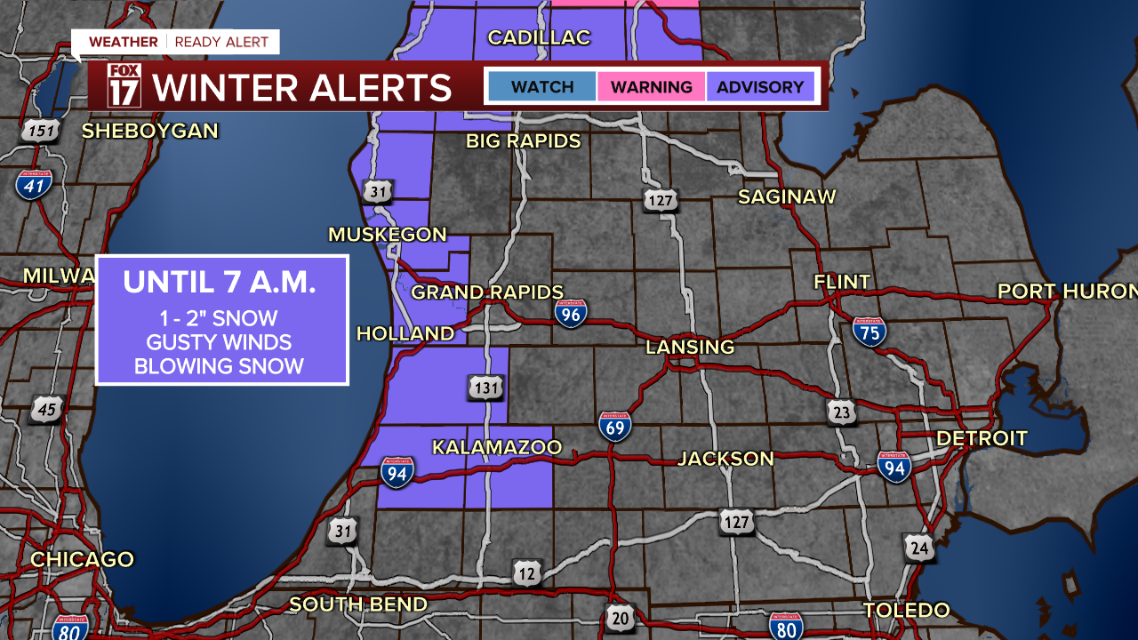
There is a WINTER WEATHER ADVISORY for the counties in purple, through 7 a.m. Thursday (New Year's Day). Another inch or so of accumulating snow will cause slick spots on the roads, and wind gusts up to 25 mph could cause reduced visibility and blowing snow.
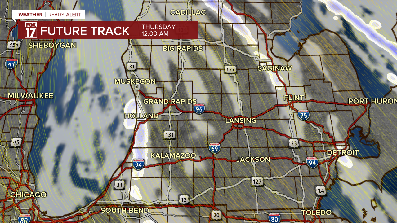
Snow developed this afternoon along a cold front, and has been moderate to heavy across much of West Michigan. Most spots picked up 2-4", with isolated higher totals of 5".
While most are now dry behind the cold front, additional areas of lake effect snow are still likely overnight especially right along the lakeshore.
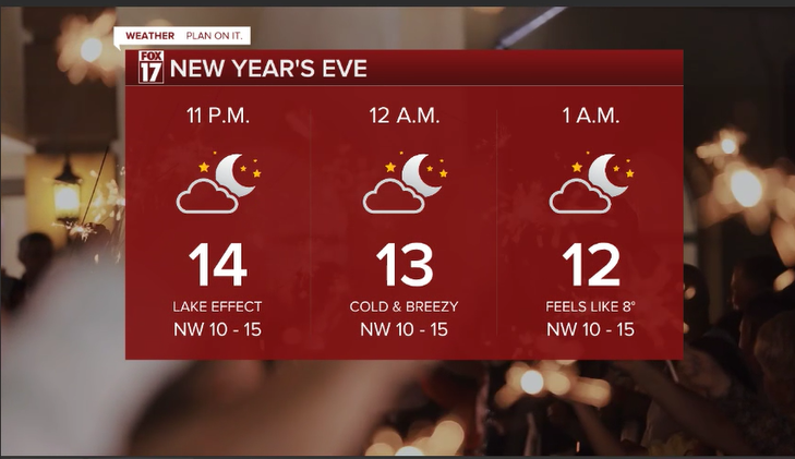
Even as the snow ends, blowing snow could still cause low visibility on the roads and contribute to travel difficulties. Slick and slushy roads are also likely, especially in more rural and lesser-traveled neighborhood streets. Be careful heading out to your New Year's Eve festivities!
New Year's Eve itself will be cold and breezy with wind chills in the single digits. You'll need to bundle up!

For the latest details on the weather in West Michigan, head to the FOX 17 Weather page.
Follow FOX 17: Facebook - X (formerly Twitter) - Instagram - YouTube
