


The forecast from FOX 17 Weather Ready Meteorologist Kara James: 80s return Friday and continue through the weekend, and each day will be within a few degrees of a record high! with increasing dew points as well, it could feel a little humid at times. This may be the last of the 80s this season/this year. For comparison: "average" this time of year are highs in the mid/upper 60s and lows in the mid/upper 40s. The drought conditions will continue to worsen across West Michigan as we stay dry through the weekend. Chances for showers are back in the forecast early next week...especially on Tuesday. Our forecast models are indicating we could tap some moisture from the Gulf of Mexico, giving us better chances for some widespread, much-needed rain. There are also indications that we expect to cool down into the 60s next week, but still staying above average. Make sure to stay with the FOX 17 Weather Ready Team for your latest forecast updates.
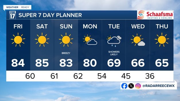
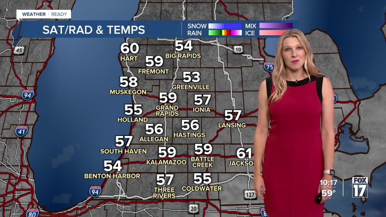
TONIGHT: Clear and comfortable. Lows in the low/mid 50s. Winds south-southeast at 5 to 10 mph.
FRIDAY: Sunny and unseasonably warm. Highs in the low/mid 80s. Winds southwest at 5 to 15 mph.
SATURDAY: Sunny and unseasonably warm. Highs in the mid 80s.
SUNDAY: Sunny and unseasonably warm. Highs in the lower 80s.
MONDAY: Mostly sunny to partly cloudy. Chance of P.M. and night showers. Highs in the upper 70s to near 80.
TUESDAY: Partly sunny to mostly cloudy and sharply cooler with a chance of showers. Highs in the upper 60s to near 70.
For the latest details on the weather in West Michigan, head to the FOX 17 Weather page.
Follow FOX 17: Facebook - X (formerly Twitter) - Instagram - YouTube
