


From Fox 17 Weather Ready Meteorologist Kara James: Roads will continue to be icy in spots overnight, especially neighborhood and rural roads. With any small breeze, feels like temperatures will drop below 0 in spots as actual temperatures fall into the single digits. Near record cold across West Michigan! Friday will be cloudy and cold as the core of the Arctic air stays overhead. A quick moving clipper system brings the chance for light snow Friday evening into early Saturday morning, but the good usable hours of the day Saturday will be dry. Snow amounts will be 1-2" at best. The overall pattern remains unseasonably cold and intermittently active, with another snow chance Sunday and again early next week.

TONIGHT: Partly clear with lows around 10 and wind chills near 0. Winds: NW 5-10 mph
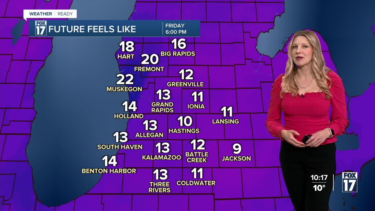
FRIDAY: Mostly cloudy and cold. Highs in the mid-20s.
SATURDAY: Early morning snow showers. Highs in the low 30s.
SUNDAY: Chance snow showers. Highs in the middle 20s.
MONDAY: Partly cloudy and cold. Highs in the lower 20s.
TUESDAY: Mostly cloudy with snow likely. Highs in the low 30s.
WEDNESDAY: Wintry mix likely with rain and slushy snow. Highs in the mid 30s.
THURSDAY: Mostly cloudy with chance snow showers. Highs in the upper 20s.
For the latest details on the weather in West Michigan, head to the FOX 17 Weather page.
Follow FOX 17: Facebook - X (formerly Twitter) - Instagram - YouTube
