
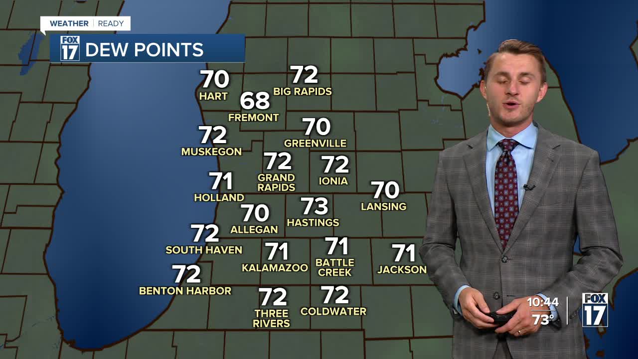


The forecast from FOX 17 Weather Ready Meteorologist Reece Cole: Areas along I-94 have received over 2" of rain in localized spots. This has led to flooding concerns this evening into Friday morning. As the front passes and widespread rain clears, muggy air remains in place through the weekend and into early next week. Friday will see the best shower chance near the state line, while Saturday looks like widespread rain and storms. We are under a MARGINAL RISK (1 out of 5) for Saturday's severe potential. Hot and humid conditions remain Sunday and Monday with highs near 90. Relief finally comes in the middle of next week! We may be able to start seeing the Perseid Meteors in the coming days, but they don't peak until August 12/13. This is an annual event and stems from debris from the tail of the comet Swift Tuttle. Stay tuned to the FOX 17 Weather Ready Team for your latest forecast updates.
TONIGHT: Chance of evening shower/storms, otherwise mostly cloudy, warm, and muggy with a chance of showers overnight. Lows in the low 70s. Winds west/north at 5 to 10 mph.
FRIDAY: Partly sunny to mostly cloudy, warm, and muggy with scattered showers/storms, especially south of Grand Rapids. Highs in the mid 80s. Winds northeast at 5 to 10 mph.
SATURDAY: Warm and muggy. Showers & thunderstorms likely. Heavy downpours possible to help alleviate drought conditions. Highs in the low to mid 80s.
SUNDAY: Mostly sunny and hot. Highs near 90.
MONDAY: Partly cloudy and muggy with showers and storms possible. Highs around 90.
TUESDAY: Chance for showers and storms. Highs in the upper 80s.
WEDNESDAY: Mostly sunny and cooler with less humidity. Highs in the lower 80s.
For the latest details on the weather in West Michigan, head to the FOX 17 Weather page.
Follow FOX 17: Facebook - X (formerly Twitter) - Instagram - YouTube
