


WEST MICHIGAN — The forecast from FOX 17 Meteorologist Anthony Domol: Clouds will increase again through Thursday morning. A weak system lifts into the region Thursday with a chance of light snow or mixed precipitation in the afternoon, especially along/north of I-96. A stronger system is on target to bring a plain rain for Friday afternoon/evening. Once we get beyond the next couple of days, above normal temperatures will be the main player over the next 7-14 days! At this point, we have at least a 90 percent chance of above normal temperatures leading almost up to Christmas. That said, it will be difficult to get accumulating snow during this time frame. It continues to look more and more like the possibility of a "green" Christmas, but stay up on later forecasts!
TONIGHT: Partly cloudy skies early, otherwise becoming mostly cloudy. Lows in the lower 20s. Winds northwest/east at 5 to 10 mph.
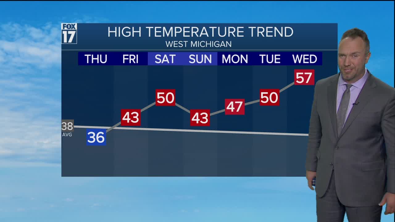
THURSDAY: Mostly cloudy with a snow/mixed rain shower possible late morning into the afternoon and early evening, especially from Grand Rapids northward. Highs in the mid 30s. Winds east-southeast 10 to 15.
FRIDAY: Mostly cloudy with rain developing by late afternoon/evening. Breezy too. Highs in the low/mid 40s.
SATURDAY: Mostly cloudy. Scattered rain showers mix with and change to snow showers. Temps peak near 50 degrees early morning, then fall through the 40s into the 30s by evening. Very windy.
SUNDAY: Mostly sunny. Highs in the low to mid 40s.
For the latest details on the weather in West Michigan, head to the FOX 17 Weather page.
