
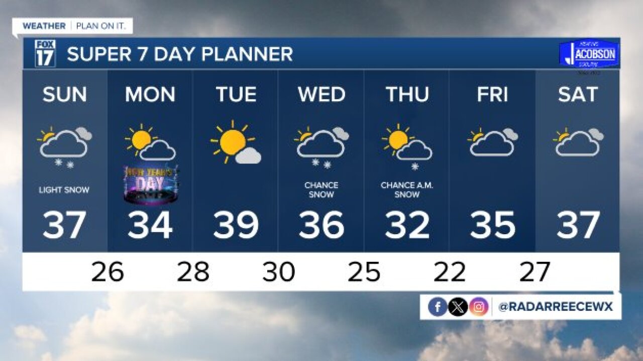


WEST MICHIGAN — The forecast from FOX 17 Meteorologist Reece Cole: Light scattered snow showers move into West Michigan early Sunday morning, New Year's Eve. Snow accumulations don't look significant for travel impacts, as most of the region will pick up less than one inch. However, overnight lows below freezing could create slick spots. Depending on Sunday's snow, this December could land as the second least snowy on record. A drier start to the New Year is anticipated on Monday, with cooler air dropping in. Forecast models hint to the potential for some snow by next Wednesday and Thursday. Make sure to stay updated on later forecasts.
TONIGHT: Mostly cloudy. Lows in the upper 20s. Winds south at 5 to 10 mph.
SUNDAY / NEW YEAR’S EVE: Mostly cloudy with light snow shower chances. Light rain could mix in at times. Accumulations under an inch. Highs in the mid 30s. Winds northwest at 5 to 10 mph.
MONDAY / NEW YEAR'S DAY: Partly cloudy skies. Highs in the mid 30s.
TUESDAY: Partly cloudy to mostly sunny. Highs in the upper 30s.
WEDNESDAY: Mostly cloudy with light snow shower chances. Highs in the mid 30s.
THURSDAY: Partly cloudy with lingering flurries. Highs in the mid 30s.
FRIDAY: Mostly cloudy. Highs in the mid 30s.
For the latest details on the weather in West Michigan, head to the FOX 17 Weather page.
