
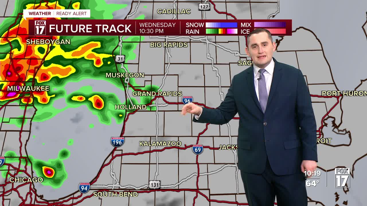


The forecast from FOX 17 Weather Ready Meteorologist Kara James: Our active weather week continues with rain and thunderstorm chances again overnight and tomorrow. There is a threat for a few strong to severe storms through the early morning, with damaging winds as the main threat. West Michigan is in a MARGINAL RISK (Level 1 out of 5) south of I-96 for severe storms. Grand Rapids northward is not under a severe weather outlook. There is a WEATHER READY ALERT tonight to account for the severe weather threat. Damaging wind gusts are the main threat , along with flooding rain. River levels will keep rising, and will stay elevated through next week. A Flood Watch has been issued for the ENTIRE STATE of Michigan until early Friday morning with another 1" to 2" of rain on the way. More rain and storms are likely on Saturday as a cold front pushes through and ends this active stretch.
TONIGHT: WEATHER READY ALERT! Wind gusts are the main threat with any storms, especially south of Grand Rapids. Lows in the upper 50s. Winds southwest at 5 to 10 mph. Winds south-southwest at 5 to 10 mph.
THURSDAY: Mostly cloudy with a chance of showers/storms. Highs in the upper 60s. Winds southwest/west at 5 to 15 mph.
FRIDAY: Partly cloudy to partly sunny and unseasonably warm. Highs in the low to mid 70s.
SATURDAY: Cloudy with showers and thunderstorms likely. Some may be strong to severe. Highs in the mid/upper 60s.
SUNDAY: Mostly cloudy and sharply colder. Highs in the mid 40s.
MONDAY: Partly cloudy and cool. Highs around 50.
TUESDAY: Mostly cloudy and warmer. Highs in the mid 60s.
WEDNESDAY: Partly cloudy with highs in the mid 50s.
Want alerts when inconvenient or severe weather is headed your way? Download the FOX 17 Weather app and set up notifications for where you live.
For the latest details on the weather in West Michigan, head to the FOX 17 Weather page.
Follow FOX 17: Facebook - X (formerly Twitter) - Instagram - YouTube
