


From Fox 17 Weather Ready Meteorologist Kara James: The pattern remains unseasonably cold and active through the weekend. Most stay dry overnight save for a few light flurries, but all of West Michigan will be cold with lows in the teens. An Arctic cold front is arriving tomorrow evening, bringing another chance for widespread light snow as well as a major cold blast. Snow totals through Saturday could be 2-4" near the lakeshore and 1-2" elsewhere. The core of the cold will be Saturday through Monday, with single digit morning temperatures and afternoons in the teens. Gusty 20-30 mph winds will make mornings feel as cold as -10 and afternoons around 0, or colder. There are a few hints of a warmer pattern by mid-week next week-at least getting above freezing!

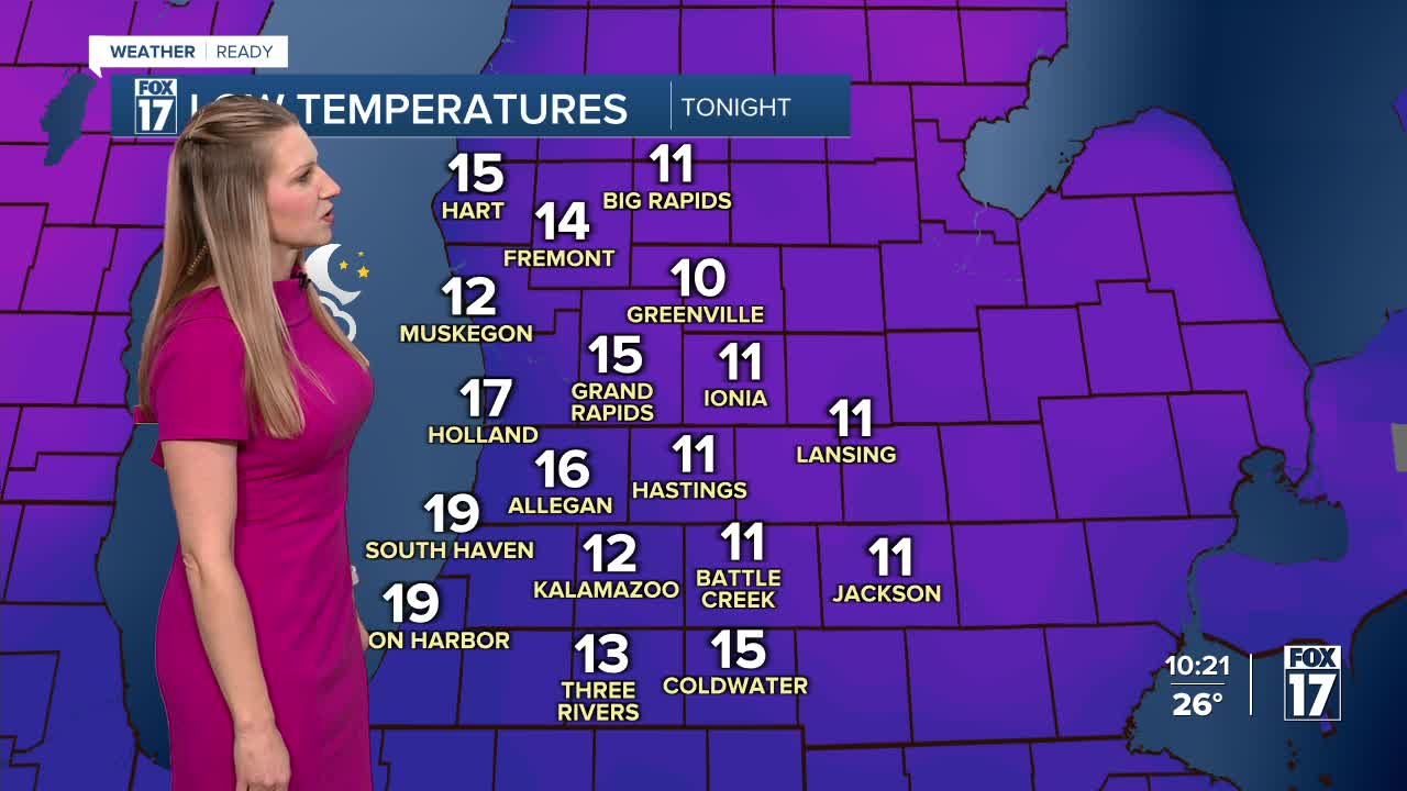
TONIGHT: Mostly to partly cloudy and cooler. Lows in the middle teens. Light & variable wind.
FRIDAY: Mostly cloudy and cold. Snow showers late. Highs in the middle 20s.
SATURDAY: Cloudy and breezy with highs in the teens. Chance snow showers, especially in the morning. Feels like 10 or lower.
SUNDAY: Cloudy and breezy with light snow possible. Highs in the low 20s.
MONDAY: Cold and mainly dry. Highs in the low 20s.
TUESDAY: Cloudy and cold with highs around 30.
WEDNESDAY: Chance rain showers. Highs in the mid 30s.
THURSDAY: Chance rain showers. Highs in the mid 30s.
For the latest details on the weather in West Michigan, head to the FOX 17 Weather page.
Follow FOX 17: Facebook - X (formerly Twitter) - Instagram - YouTube
