

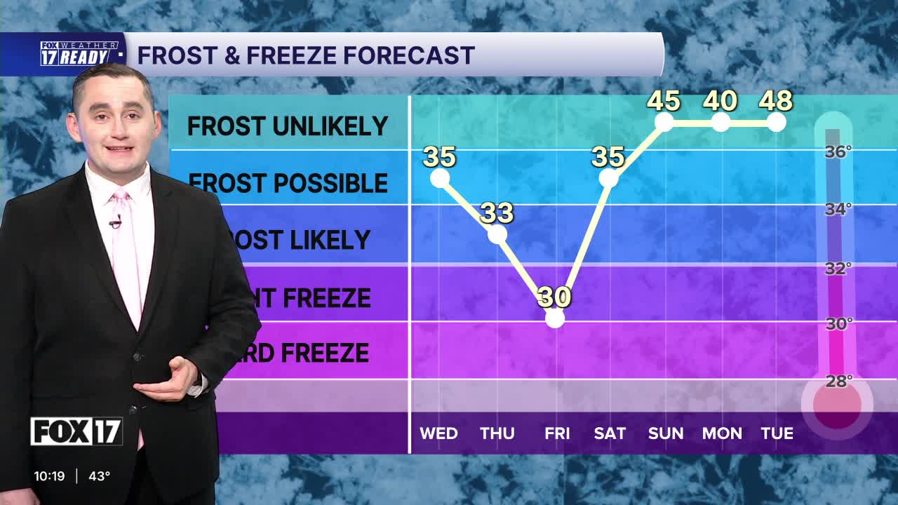



The forecast from FOX 17 Weather Ready Meteorologist Kara James: The rest of this week and into the weekend remain cooler than average with frost/freeze concerns from tonight until Sunday morning. There is a FROST ADVISORY for Newaygo, Montcalm, Kent, Ionia, Barry and Eaton counties through 9 a.m. Thursdsay, and a FREEZE WARNING for Mecosta County. Temperatures overnight will be anywhere from 30 to 36. Cover your plants, and prepare to keep them covered each night through Sunday morning. The best chance for a freeze will be Thursday and Friday nights. High temperatures the next several days and into next week are expected to only climb into the low 50s, well below our normal/average high of 64. We expect the first full week (or even a little longer) of May to stay below average highs. Scattered showers are possible Thursday and Friday, with better rain chances returning Sunday night into Monday, and Tuesday night into Wednesday.
TONIGHT: Becoming partly cloudy. Areas of frost possible. Lows in the middle 30s. Winds northwest at 5 to 10 mph.
THURSDAY: Partly cloudy to partly sunny with a slight chance of a shower or sprinkles. Highs in the lower 50s. Winds northwest/west at 5 to 15 mph.
FRIDAY: Morning frost likely. Morning sunshine, increasing P.M. clouds and cold. Highs only in the upper 40s to near 50.
SATURDAY: Morning frost likely. Mostly sunny and cool. Highs in the low 50s.
SUNDAY: Partly cloudy and a bit warmer. Highs in the upper 50s near 60.
MONDAY: Mostly cloudy with chance showers. Highs in the low 60s.
TUESDAY: Mostly cloudy with chance showers. Highs in the low 60s.
WEDNESDAY: Mostly cloudy with chance showers. Highs in the low 60s.
Want alerts when inconvenient or severe weather is headed your way? Download the FOX 17 Weather app and set up notifications for where you live.
For the latest details on the weather in West Michigan, head to the FOX 17 Weather page.
Follow FOX 17: Facebook - X (formerly Twitter) - Instagram - YouTube
