


From Fox 17 Weather Ready Meteorologist Kara James: After a round of early-day snow moved out, we were treated to chilly sunshine! A cold high pressure cleared out the clouds as it moves overhead. This high will help to keep winds near 0 overnight as cold air flows in, helping lows to plummet into the single digits again overnight. Highs Monday will only be in the low 20s too, but at least it will be a quiet day with partial sunshine. The overall pattern remains unseasonably cold and active with multiple chances for snow this week, particularly Tuesday and Wednesday. Tuesday will be all snow, but overnight and into Wednesday a wintry mix will set up, with the best chance of temperatures above freezing and more rain than snow south of I-96. We could see a handful of inches of snow this week, and difficult travel conditions are expected at times.

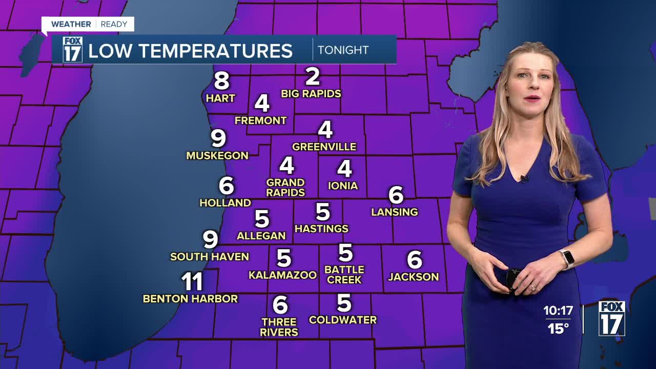
TONIGHT: Clouds gradually increase. Calm wind and very cold. Lows around 4 with some areas near zero.
MONDAY: Partly cloudy and cold. Highs in the lower 20s.
TUESDAY: Mostly cloudy with morning snow. Highs in the low 30s. More snow builds in overnight.
WEDNESDAY: Wintry mix likely with rain and slushy snow. Highs in the mid 30s.
THURSDAY: Mostly cloudy with lake effect snow showers possible. Highs in the upper 20s.
FRIDAY: Mostly cloudy and cold. Isolated snow shower. Highs in the upper 20s.
SATURDAY: Cloudy and cold with highs in the low 20s. Chance evening / night snow.
SUNDAY: Cloudy and cold with highs in the low 20s.
For the latest details on the weather in West Michigan, head to the FOX 17 Weather page.
Follow FOX 17: Facebook - X (formerly Twitter) - Instagram - YouTube
