


WEST MICHIGAN — The forecast from FOX 17 Weather Ready Meteorologist Reece Cole: Sharply colder air is in sight for the weekend, with the chance for a few showers or a wintry mix later in the day Saturday. Saturday's highs will only reach the mid-40s, with even colder air in sight for Sunday and Monday. This sharply colder air mass for Sunday comes with the potential for slushy snowflakes to mix in with rain. The "average" first snow in Grand Rapids is November 8, so this would be right on schedule. Accumulations may be slushy, but are possible! What we actually measure may be different than what falls! Stay with the FOX 17 Weather Ready Team for your latest forecast updates.
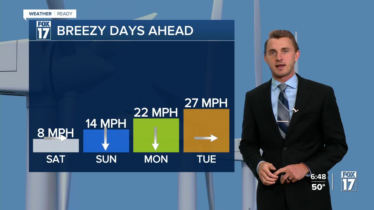
TONIGHT: Chance isolated shower or a few sprinkles. Otherwise cloudy and quiet. Lows: mid-30s. Winds: NW 5-10 mph
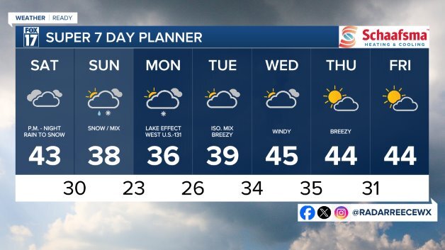
SATURDAY: Clouds thicken with cooler air. Chance of P.M./night rain to snow showers. Highs in the mid 40s. Winds: NE 5-15 mph.
SUNDAY: Mostly cloudy and cold with the chance of rain/snow showers. Highs only in the mid 30s. Accumulations possible, especially southeast of Grand Rapids.
MONDAY: Partly sunny to mostly cloudy and cold with a chance of lake effect snow showers, mainly along/west of U.S. 131. Highs only in the mid 30s.
TUESDAY: Mostly cloudy and chilly. Chance lt. wintry mix. Highs near 40-degrees.
WEDNESDAY: Partly sunny. Breezy and not as cold. Highs: mid-40s.
THURSDAY: Partly sunny. Breezy. Highs: mid-40s.
FRIDAY: Partly cloudy. Breezy. Highs: mid-40s.
For the latest details on the weather in West Michigan, head to the FOX 17 Weather page.
Follow FOX 17: Facebook - X (formerly Twitter) - Instagram - YouTube
