


From Fox 17 Weather Ready Meteorologist Reece Cole: After very heavy lake effect snow showers over the past 24-hours, we are finally in a quiet window, albeit a small one. Even though we are not expecting additional heavy snow, we have a cold front dipping down from the northwest looking to bring another 1" to 2" of snow Wednesday. Expect snow-covered and potentially slippery spots on untreated roads Wednesday evening. Overnight lows will be in the teens, and single digits for some, Thursday & Friday mornings, so expect icy spots on the roads! The overall pattern remains unseasonably cold and intermittently active, with more light snow Friday night, and another system Monday into Tuesday.
TONIGHT: Mostly cloudy and cold in the teens. Winds: SW 5-10 mph
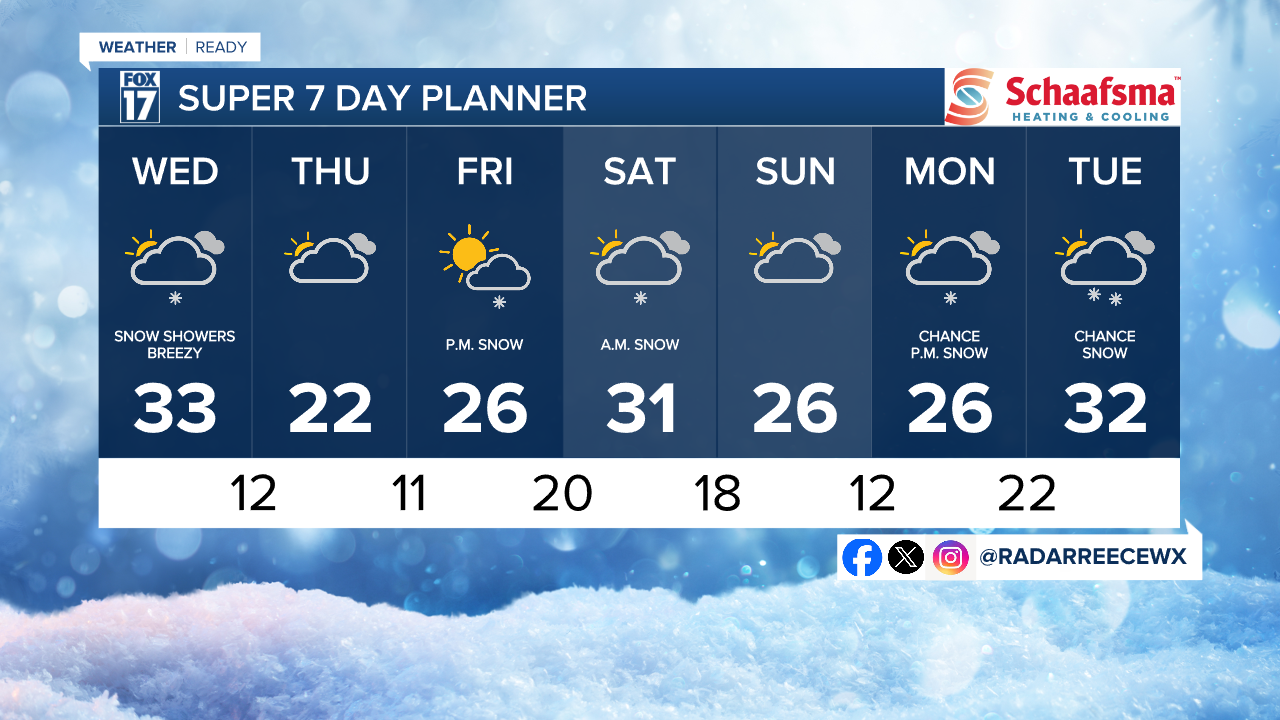
WEDNESDAY: Light snow ahead of a cold front with 1 to 2" of new snow. Highs in the low 30s with West/southwest winds at 10-20 mph.
THURSDAY: Sharply colder with partial sunshine. Highs in the low-20s.
FRIDAY: Mostly Cloudy and cold. Highs in the mid-20s.
SATURDAY: Chance snow. Highs in the low 30s.
SUNDAY: Chance few snow showers. Highs near 30-degrees.
MONDAY: Cloudy early with afternoon and evening snow showers. Highs in the upper 20s.
TUESDAY: Mostly cloudy with snow likely. Highs in the low 30s.
For the latest details on the weather in West Michigan, head to the FOX 17 Weather page.
Follow FOX 17: Facebook - X (formerly Twitter) - Instagram - YouTube
