
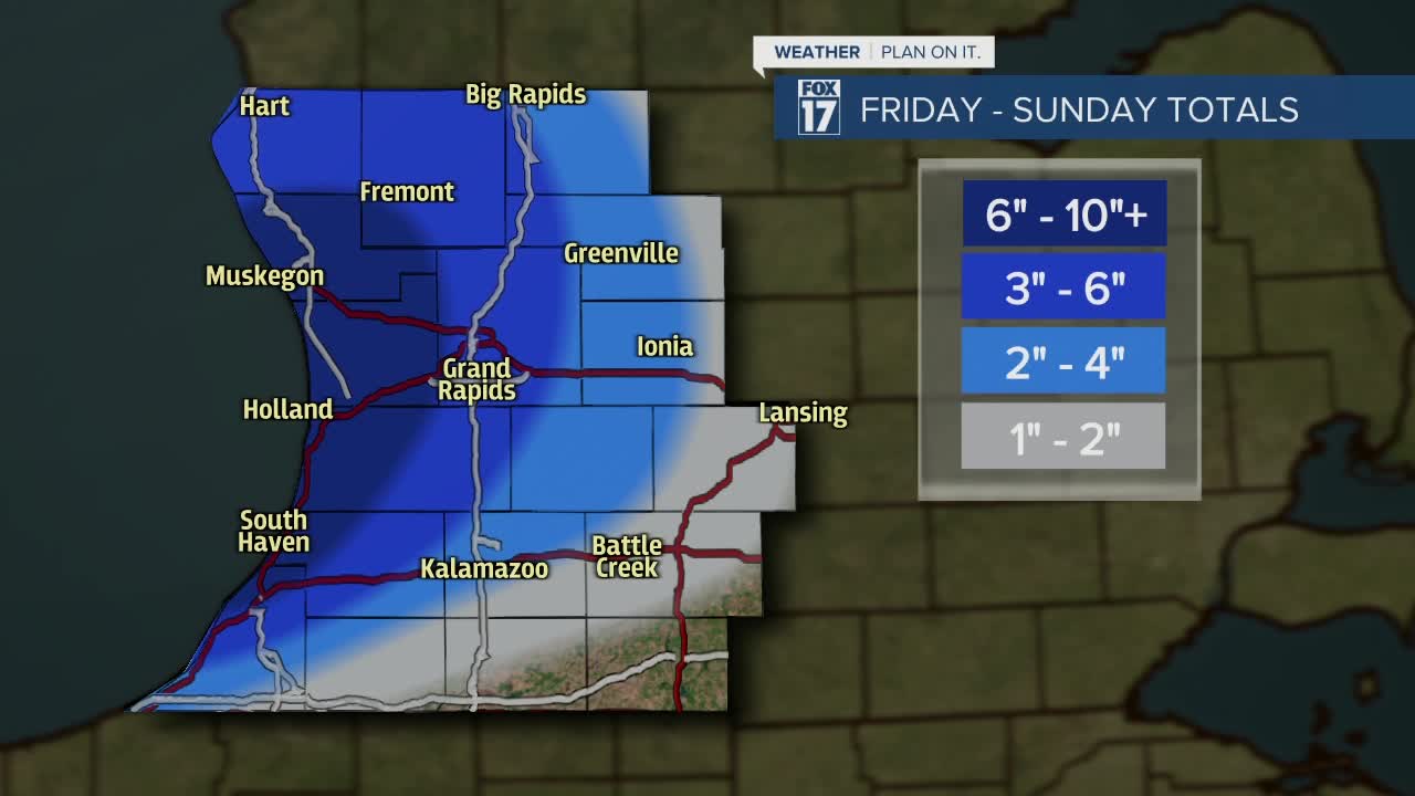


WEST MICHIGAN — The forecast from FOX 17 Meteorologist Haleigh Vaughn: Brisk winds from the southwest and west are anticipated to continue tonight, along with accumulating lake effect snow showers. Lake effect will continue on Saturday, with precipitation dwindling on Sunday. High temperatures this weekend will be near 30 degrees. A WINTER WEATHER ADVISORY has been issued for Allegan, Barry, Northern Berrien, Ionia, Mecosta, Montcalm, Muskegon, Newaygo, Oceana, Osceola, Ottawa, Kent, and Van Buren Counties until 1 a.m. Sunday morning. From Friday to Sunday, we're expecting snowfall totals to add up between 1" to 3" inches per day for locations roughly east of U.S. 131. For locations roughly west of U.S. 131 and north of I-94, about 2" to 4" inches per day are possible Friday through Sunday. That would add up to about 6 to 10 inches over the three day span primarily north of I-94 and west of U.S. 131. A few spots will see up to 12" by Sunday! Dry skies return for Monday before another wave of snow is likely on Tuesday. Look for a large blast of arctic air next week! Daytime highs will only be in the lower 20s with overnight lows in the teens. This could lead to more chances of snow next week! Looking for information on whether we could see a White Christmas? Click here for more on whether we could see a White Christmas! Stay tuned with the FOX 17 Weather Team for updates as Christmas gets closer. Download the free FOX 17 Weather App for the latest forecast video.
TONIGHT: Cloudy with snow showers likely. Another 1" to 3" of accumulation likely. Lows in the upper 20s. Winds southwest at 10 to 15 mph.
SATURDAY: Cloudy and breezy with lake effect snow showers. Another 1" to 3" likely. Highs near 30 degrees. Winds west-southwest at 10 to 15 mph.
SUNDAY: Mostly cloudy with lake effect snow showers diminishing by mid-day. Highs near 30 degrees.
MONDAY: Mostly cloudy with the chance of flurries. Highs in the upper 20s.
TUESDAY: Mostly cloudy with the chance of snow showers. Highs near 30 degrees.
WEDNESDAY: Mostly cloudy with the chance of flurries. Highs in the middle to lower 20s.
THURSDAY: Chance of snow showers and cold temperatures! Highs in the lower 20s.
For the latest details on the weather in West Michigan, head to the FOX 17 Weather page.
