


WEST MICHIGAN — The forecast from FOX 17 Meteorologist Haleigh Vaughn: As a cold front passes over West Michigan tonight, a few light rain showers are possible. Take your time while traveling tonight, as roadways will be damp. A few sprinkles are possible early in the morning on Black Friday, however dry skies are likely for the majority of the day. Cloud cover will gradually decrease through the day on Friday, making way for endless sunshine! Your Saturday looks ideal with mostly sunny skies and high temperatures in the lower 50s. A better opportunity for widespread rain showers sweeps in on Sunday. A few wet snowflakes could mix in north of Grand Rapids, but this event will mainly be rain. Don't forget your rain gear on Sunday, as you'll need it all day! Clouds hang around for Monday and Tuesday, with our next system on track for Wednesday. The system on Wednesday will bring dropping temperatures and rain transitioning over to snow. Download the free FOX 17 Weather App for the latest forecast video.
TONIGHT: Isolated showers with otherwise mostly cloudy skies. Lows in the upper 30s. Winds southwest/west at 5 to 15 mph.
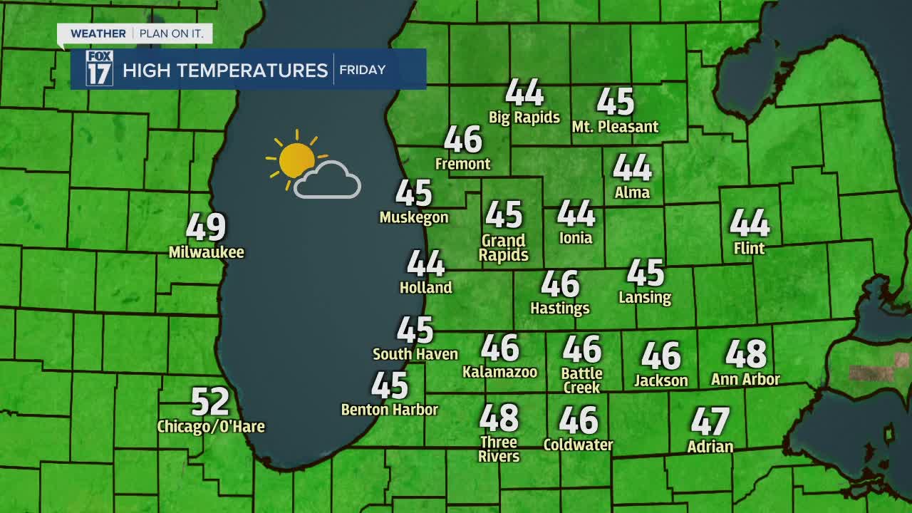
FRIDAY: Decreasing cloud cover, becoming mostly sunny. Highs in the low/mid 40s. Winds west/northwest at 10 to 15 mph.
SATURDAY: Mostly sunny to partly cloudy. Clouds gradually increase overnight, with the chance of showers after Midnight. Highs in the lower 50s.
SUNDAY: Mostly cloudy with a chance of rain showers. Some snow mixing in is possible. Highs in the lower 40s.
MONDAY: Mostly cloudy. Highs in the lower 40s.
TUESDAY: Mostly cloudy with night rain showers building in. Highs in the upper 40s.
For the latest details on the weather in West Michigan, head to the FOX 17 Weather page.
