
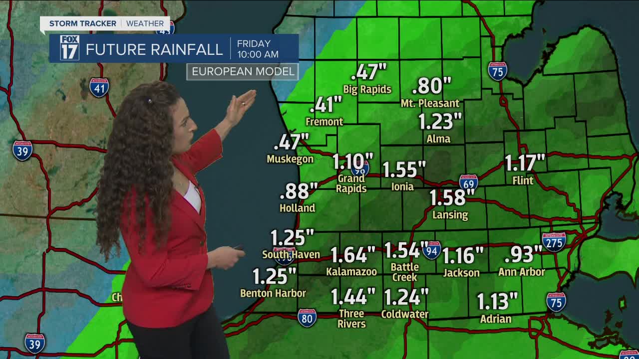


WEST MICHIGAN — The forecast from FOX 17 Meteorologist Laura Velasquez: Significant rain and wind arrive tonight with a low pressure system tracking north from Texas. This storm system is our best chance in the extended forecast for a soaking rain across the region to help alleviate the high fire threat and very dry vegetation. By the time it exits Friday morning, many spots will have seen 1"+ of rainfall. Cooler temps will follow this system on Friday, with us actually going below normal with our temperatures. We will see another jump in our temps on Saturday, with all of us getting well into the 50s and 60s. With the warmer temps comes another chance for rain showers Saturday afternoon and evening. Sunday looks dry but windy with another cool down into the 40s.
TONIGHT: Cloudy and windy with heavy rain. A rumble of thunder is also possible near and SE of I-69. Snow/sleet could mix-in late for northern areas. Lows in the mid/upper 30s. Winds northeast/north at 15 to 25 mph with gusts between 35 and 45 mph.
FRIDAY: Rain lingers into mid-morning. Some afternoon/evening sunshine emerges. Otherwise, breezy, brisk, and chillier. Highs in the middle to upper 40s. Winds northwest/west at 10 to 15 mph, gusts to 25 mph.
SATURDAY: Increasing clouds with a chance for afternoon and evening scattered showers. Thunder possible. Highs in the middle 50s to lower 60s.
SUNDAY: Decreasing morning clouds. Lots of p.m. sunshine. Windy! Highs in the mid 40s.
MONDAY: Partly cloudy. Highs in the middle/upper 50s.
TUESDAY: Partly cloudy. Highs in the upper 50s.
