


The forecast from FOX 17 Weather Ready Meteorologist Kara James: A cold front continues to slowly push through West Michigan, but should not bring any additional rain or thunderstorms. Behind the front into early tomorrow morning, dew points drop as high pressure settles in! Cooler and less humid weather prevails Tuesday with highs around average for this time of year, the low 80s. Mostly sunny, less humid and pleasantly warm days continue through Thursday. Humidity will be on the increase again starting Thursday night into the weekend. The 4th of July (Friday) looks mostly dry and hot, but thunderstorm chances are building for the weekend. Stay tuned to the FOX 17 Weather Ready Team for your latest forecast updates.
TONIGHT: Less humid air arrives overnight as the cold front sweeps east. Lows in the mid-60s. Winds: W 5-10 mph
TUESDAY: Mostly sunny and pleasant. Highs in the low/mid 80s.
WEDNESDAY: Mostly sunny and pleasant. Highs in the mid to upper 80s.
THURSDAY: Mostly sunny to partly cloudy. Highs in the mid to upper 80s.
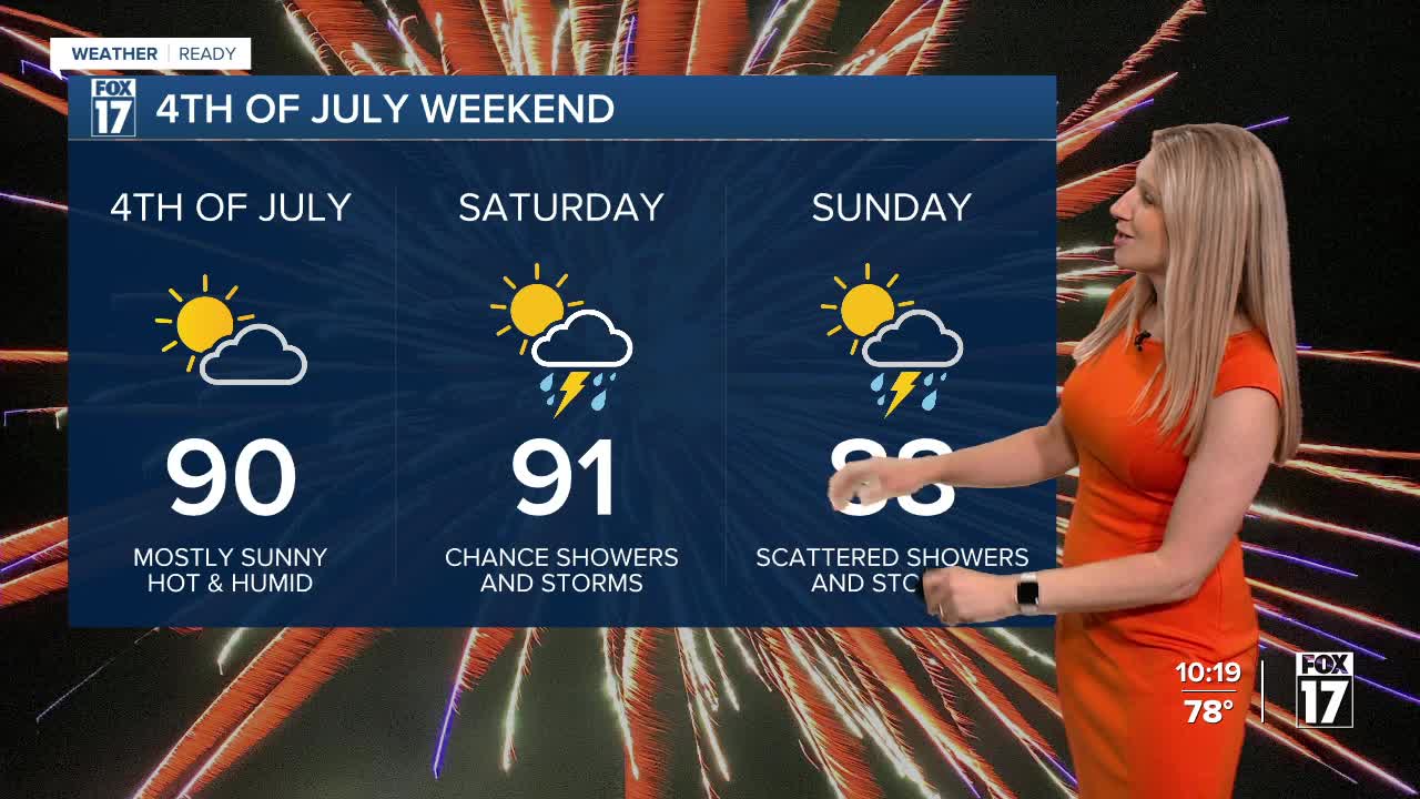
FRIDAY: Partly cloudy and hot. Highs in the mid to upper 80s.
SATURDAY: Very warm. Muggier. Slight chance isolated shower or storm. Highs in the low 90s.
SUNDAY: Hot and muggy with rain and thunderstorms along a cold front. Highs around 90.
MONDAY: Sunny and warm. Not as humid. Highs in the upper 80s.
For the latest details on the weather in West Michigan, head to the FOX 17 Weather page.
Follow FOX 17: Facebook - X (formerly Twitter) - Instagram - YouTube
