
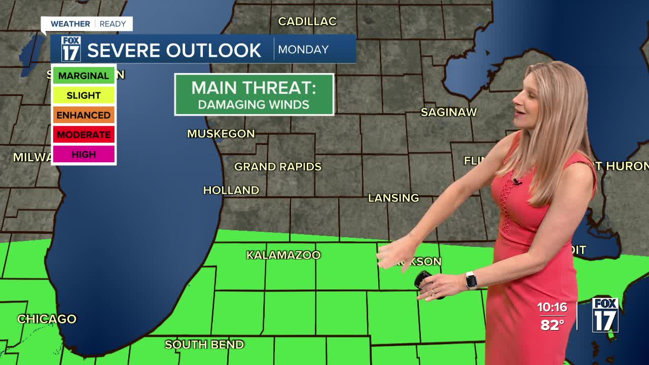


WEST MICHIGAN — The forecast from FOX 17 Weather Ready Meteorologist Kara James: A weakening line of thunderstorms moving across Lake Michigan will try to reach the lakeshore overnight, but most stay dry. Isolated showers are possible overnight ahead of the line as it remains warm and muggy. A cold front approaches tomorrow, with scattered showers and thunderstorms likely in the afternoon and evening. Some could be strong or even severe, with damaging winds as the main threat. A portion of West Michigan is included in the Marginal Risk (Level 1 out of 5) for severe weather, mainly from I-94 and south. Heavy downpours and lightning are expected in any storms. Behind the front, the middle part of the week will be mostly sunny, less humid and seasonal although humidity values and temperatures do climb by Thursday. The 4th of July (Friday) looks mostly dry and hot, but thunderstorm chances are building for next weekend. Stay tuned to the FOX 17 Weather Ready Team for your latest forecast updates.
TONIGHT: Partly cloudy with isolated showers and thunderstorms possible. Very warm and muggy. Lows near 70. Winds: S 5-10 mph
MONDAY: Partly sunny to mostly cloudy, warm, and muggy. Scattered showers and thunderstorms, mainly during the afternoon and evening. Highs in the upper 80s.
TUESDAY: Mostly sunny and pleasant. Highs in the low/mid 80s.
WEDNESDAY: Mostly sunny and pleasant. Highs in the mid to upper 80s.
THURSDAY: Partly cloudy. Chance of a shower/storm. Highs in the mid to upper 80s.
FRIDAY: Partly cloudy and hot. Highs in the mid 80s.
SATURDAY: Very warm. Muggier. Slight chance isolated shower or storm. Highs in the low 90s.
SUNDAY: Hot and muggy with rain and thunderstorms along a cold front. Highs around 90.
For the latest details on the weather in West Michigan, head to the FOX 17 Weather page.
Follow FOX 17: Facebook - X (formerly Twitter) - Instagram - YouTube
