


WEST MICHIGAN — The forecast from FOX 17 Weather Ready Meteorologist Reece Cole: The HEAT ADVISORY expires this evening as the worst of the warmth shifts east. Beach Hazards and Small Craft Advisories also come to an end as the southwest wind calms some. Overnight lows have been some of the warmest on record, and that continues tonight with low to mid 70s, as many communities will set June 24 Low records. Highs on Tuesday will still be in the upper 80s to lower 90s, but clouds increase with showers and storms popping up in the afternoon. A few may be on the stronger side with gusty winds and heavy downpours. A front stalls in the region once again, bringing persistent precipitation chances through the end of the week. Stay tuned to the FOX 17 Weather Ready Team for your latest forecast updates.
TONIGHT: Clear and very warm. Lows in the mid-70s. Winds: SW 5-15 mph
TUESDAY: Mostly sunny to partly cloudy, hazy, hot, and humid. Chance of an afternoon shower/storm. Highs around 90.
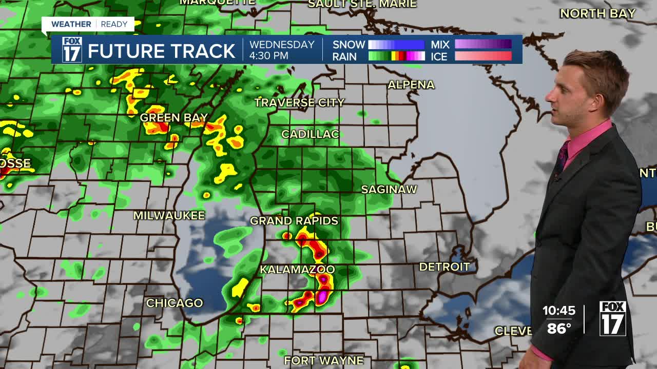
WEDNESDAY: Partly cloudy to partly sunny. Scattered showers and thunderstorms. Highs in the mid/upper 80s.
THURSDAY: Partly Cloudy. Chance Shower/Storm. Remaining very warm. Highs in the mid-80s.
FRIDAY: Partly Cloudy. Chance Shower/Storm. Remaining unseasonably warm. Highs in the mid-80s.
SATURDAY: Partly Cloudy. Chance Shower/Storm. Warm. Highs in the mid-80s.
SUNDAY: Partly cloudy and Very Warm. Highs in the upper 80s.
For the latest details on the weather in West Michigan, head to the FOX 17 Weather page.
Follow FOX 17: Facebook - X (formerly Twitter) - Instagram - YouTube
