
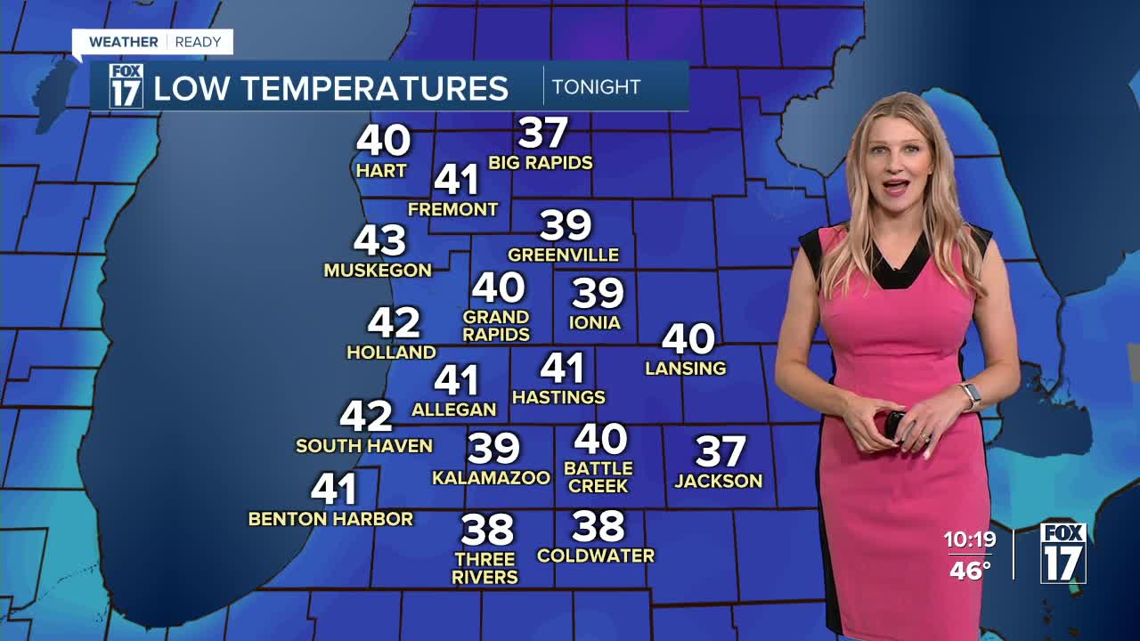


The forecast from FOX 17 Weather Ready Meteorologist Kara James: Cool air lingers over West Michigan overnight, but it won't be quite as cold as what we woke up to Thursday morning! Most will end up around 40 overnight, too warm for frost, but low-lying spots east of 131 have a Frost Advisory through 9 a.m. Friday. There is a slight chance of light showers Friday afternoon and evening, but nothing that will impact outdoor plans or be significant enough to chip away at our deficit. Friday will also be breezy, with gusts up to 25 mph possible especially at the lakeshore. A SMALL CRAFT ADVISORY was issued through Saturday at 11 a.m. for waves 6-9 feet. Temperatures gradually warm up this weekend and early next week back into the 70s, above average once again. Stay with the FOX 17 Weather Ready Team for your latest forecast updates.

TONIGHT: Cool again with clear skies. Lows in the middle to upper 30s. Winds light out of the southeast.
FRIDAY: Mostly sunny to partly cloudy. Clouds increase in the afternoon with a chance of scattered evening/night showers. Highs in the mid 60s.
SATURDAY: Some morning cloudiness, otherwise mostly sunny. Highs in the mid 60s.
SUNDAY: Mostly sunny and pleasant. Highs in the upper 60s to near 70.
MONDAY: Mostly sunny with highs around 70.
TUESDAY: Mostly sunny with highs around 70.
WEDNESDAY: Partly cloudy with highs in the upper 60s.
THURSDAY: Partly cloudy with highs in the mid 60s.
For the latest details on the weather in West Michigan, head to the FOX 17 Weather page.
Follow FOX 17: Facebook - X (formerly Twitter) - Instagram - YouTube
