


The forecast from FOX 17 Weather Ready Meteorologist Kara James: Winds are starting to relax after peaking at 50-60 mph for most of the day across West Michigan. Clouds are clearing as well, with lows expected to fall into the mid 20s overnight. Most of Saturday looks dry and cool, but Saturday night into Sunday another system arrives. This systems bears watching as we are currently seeing rain, snow, wintry icy mix, and perhaps a thunderstorm in spots. Some models bring mostly rain and a little snow to West Michigan, while others bring more wintry weather. Any accumulation in our area would likely occur from Grand Rapids to the north. This will be a system to keep an eye on in the days to come as travel impacts could be possible Sunday. The system looks to produce very heavy snow across northern lower Michigan and north central lower Michigan. Beyond that system we cool down even further with some lake effect snow showers possible early next week.
TONIGHT: Becoming partly cloudy. Winds diminishing. Lows in the mid 20s. Winds decreasing from the northwest at 10 to 20 mph.
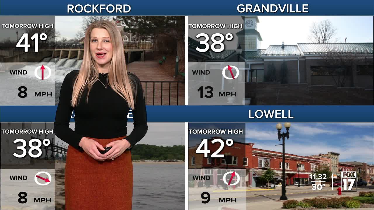
SATURDAY: Mostly cloudy. Highs in the upper 30s. Winds variable at 5 to 10 mph. Look for a quick burst of snow to develop after midnight as our next winter storm arrives.
SUNDAY: WEATHER WEATHER ALERT Cloudy and windy with a icy mix of rain, snow, sleet, freezing rain, before changing to all rain for much of the area. A thunderstorm possible too. Ice and snow accumulation is possible north of Grand Rapids. This will be a major winter storm across northern lower Michigan and portions of the upper peninsula. Highs in the mid 50s, and windy.
MONDAY: Cloudy, windy, and sharply colder with rain changing to snow in the early morning. Accumulations possible. Highs in the predawn hours in the low/mid 50s, then falling into the 30s.
TUESDAY: Mostly cloudy, breezy, and cold with lake effect snow showers. Highs in the mid 20s.
WEDNESDAY: Mostly cloudy with chance snow showers. Highs in the mid 30s.
THURSDAY: Partly cloudy and warmer with highs in the mid/upper 40s.
FRIDAY: Partly cloudy with highs in the low 50s.
For the latest details on the weather in West Michigan, head to the FOX 17 Weather page.
Follow FOX 17: Facebook - X (formerly Twitter) - Instagram - YouTube
