
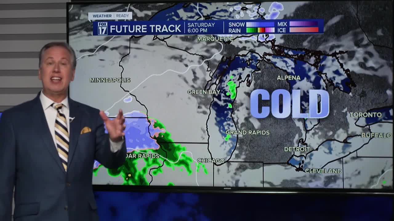


The forecast from FOX 17 Weather Ready Chief Meteorologist Kevin Craig: Look for a cold and frosty start this morning with lows in the 30s! We expect morning sunshine today, but increasing afternoon clouds with highs in the lower 50s. Friday brings another fast-moving clipper system. Rain develops after midnight tonight and carries into Friday morning. Look for a quarter to third of an inch. Highs Saturday will only be in the middle 40s ahead of an approaching low. This brings a sharply colder air mass by Sunday, with the potential for slushy snowflakes to mix in with rain. The "average" first snow in Grand Rapids is November 8, so this would be right on schedule. Accumulations are likely, especially south of Grand Rapids and at the lakeshore Saturday night through Monday. Early indications show about 1" to 3" (perhaps 2" to 4") possible south of Grand Rapids, and higher amounts at/near the lakeshore into early next week. What we acvtually measure may be different than what falls! Sometimes these early season snow systems can catch people off-guard with a warm ground and folks not expecting accumulations. That said, these types of systems can "overperform" with cold air firmly in place, so be ready for at least the possibility of accumulations! Stay with the FOX 17 Weather Ready Team for your latest forecast updates.
TODAY: A cold, frosty start, otherwise morning sunshine, but increasing afternoon clouds.. Highs in the lower 50s. Winds south/southwest at 5 to 10 mph.
TONIGHT: Becoming cloudy and breezy with rain developing after midnight. Lows in the low/mid 30s. Winds south at 10 to 20 mph.
FRIDAY: Cloudy and breezy with morning rain showers likely. Partly cloudy to partly sunny in the afternoon with a chance of showers. Highs in the mid 50s. Winds southwest/west at 10 to 20.
SATURDAY: Mostly cloudy and cooler. Chance of P.M./night rain/snow showers. Highs in the mid 40s.
SUNDAY: Mostly cloudy and cold with the chance of rain/snow showers. Highs only in the mid 30s. Accumulations possible.
MONDAY: Partly sunny to mostly cloudy and cold with a chance of lake effect snow showers, mainly along/west of U.S. 131. Highs only in the mid 30s.
TUESDAY: Mostly cloudy and chilly with highs around 40.
For the latest details on the weather in West Michigan, head to the FOX 17 Weather page.
Follow FOX 17: Facebook - X (formerly Twitter) - Instagram - YouTube
