
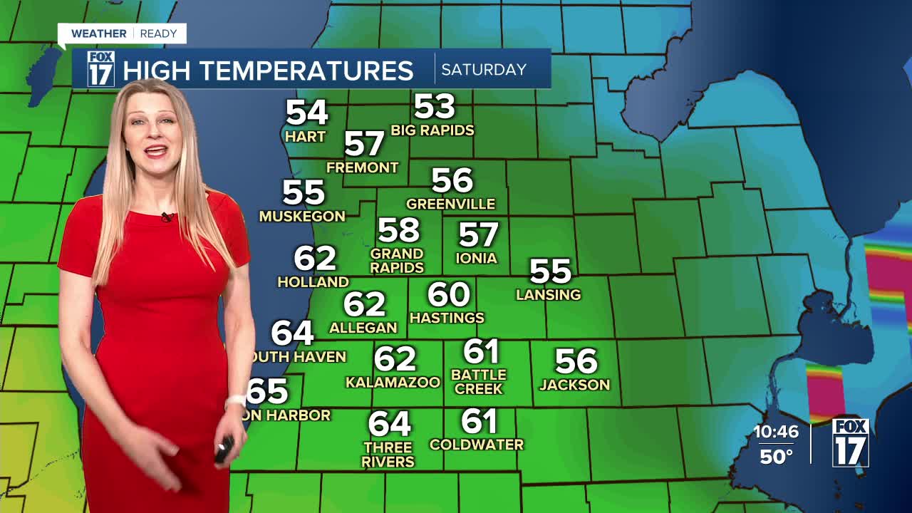


The forecast from FOX 17 Weather Ready Meteorologist Kara James: After a beautiful start to Spring today, the warmer temperatures continue through this weekend. Tonight will be mostly cloudy with lows in the low 30s, which is several degrees above average. Saturday will be a great Spring day with sun and clouds and highs in the upper 50s! A cold front Sunday brings the chance for some light rain but it will not be a washout. Amounts will be around a tenth of an inch, not enough to stress area rivers. There are no major weather systems on the horizon at this time. Early next week, mornings will be in the upper 20s and afternoons in the mid 40s to around 50, which is close to average for this time of year.
TONIGHT: Mostly cloudy. Lows in the lower 30s. Winds from NE at 5 to 10 mph.
SATURDAY: Partly cloudy to partly sunny and mild. Highs in the upper 50s. Wind: SW 5 to 15 mph.
SUNDAY: Mostly cloudy with scattered rain showers. Highs in the low to mid 50s. Wind: NE 10 - 15, gusting to 20 mph.
MONDAY: Mostly sunny and cooler. Highs in the lower 40s.
TUESDAY: Partly cloudy to partly sunny. Highs in the mid/upper 40s.
WEDNESDAY: Mostly cloudy with highs in the upper 40s.
THURSDAY: Mostly cloudy with scattered showers. Highs in the lower 50s.
FRIDAY: Partly cloudy with highs in the mid 40s.
For the latest details on the weather in West Michigan, head to the FOX 17 Weather page.
Follow FOX 17: Facebook - X (formerly Twitter) - Instagram - YouTube
