
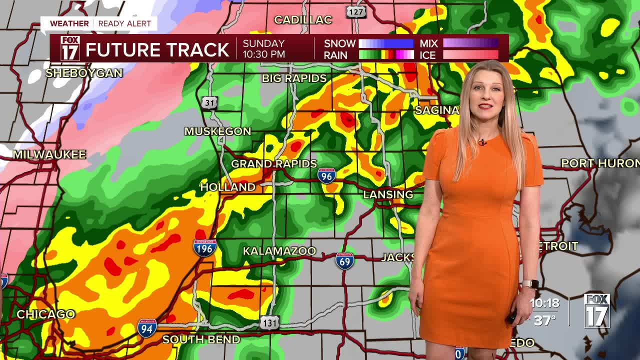


The forecast from FOX 17 Weather Ready Meteorologist Kara James: A very strong storm system will move through the Great Lakes region tonight and tomorrow. A powerful cold front will then arrive this evening and overnight and with it a round of showers and thunderstorms. Some of these storms could be strong to severe weather with wind gusts of 60 mph the main threat. Heavy rain could lead to ponding on the roads as well. Once the cold front goes by, much colder air comes into the area late tonight into Monday morning. This will change rain to snow showers, with several inches of accumulation possible west of 131, where there is a WINTER WEATHER ADVISORY from 8 a.m. Monday to 11 p.m. Tuesday. Monday will be much colder with breezy conditions and scattered snow showers. There is a WIND ADVISORY for much of West Michigan until 11 p.m. Monday for gusts of 40 to 50 mph possible. Blowing snow and reduced visibility likely Monday.
TONIGHT: WEATHER READY ALERT: Showers and thunderstorms likely before midnight. A few storms could be severe, with damaging wind gusts possible from Grand Rapids south. Colder air comes after midnight causing rain to change to snow. Breezy. Lows in the upper 20s.
MONDAY: WEATHER READY ALERT: Cloudy and windy with early morning rain changing to snow showers. 2" to 4" of snow possible along/west of U.S. 131. Sharply colder with temperatures falling into the 20s by afternoon. Wind gusts 40 to 50 mph. Travel impacts likely.
TUESDAY: Mostly cloudy, breezy, and cold with lake effect snow showers early. Highs in the low/mid 20s.
WEDNESDAY: Mostly cloudy with chance snow showers. Highs in the mid 30s.
THURSDAY: Partly sunny to mostly cloudy. Chance of rain/snow showers. Highs in the mid/upper 40s.
FRIDAY: Partly cloudy with highs in the low 50s.
SATURDAY: Partly cloudy with highs in the upper 40s.
SUNDAY: Mostly cloudy with highs around 50.
For the latest details on the weather in West Michigan, head to the FOX 17 Weather page.
Follow FOX 17: Facebook - X (formerly Twitter) - Instagram - YouTube
