


WEST MICHIGAN — Snowfall is still running feet, yes feet, below normal up to this point in the year. Grand Rapids has reported only 7.5" of snow for the 2020-2021 season. Average snowfall is 40.4" up to today, January 16.
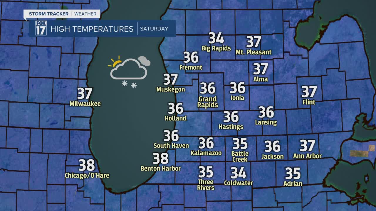
We need the snow, and luckily for you snow lovers, we are going to get some this weekend! Snow showers will be scattered about the area today, but the best chance of snow won't begin until tonight.

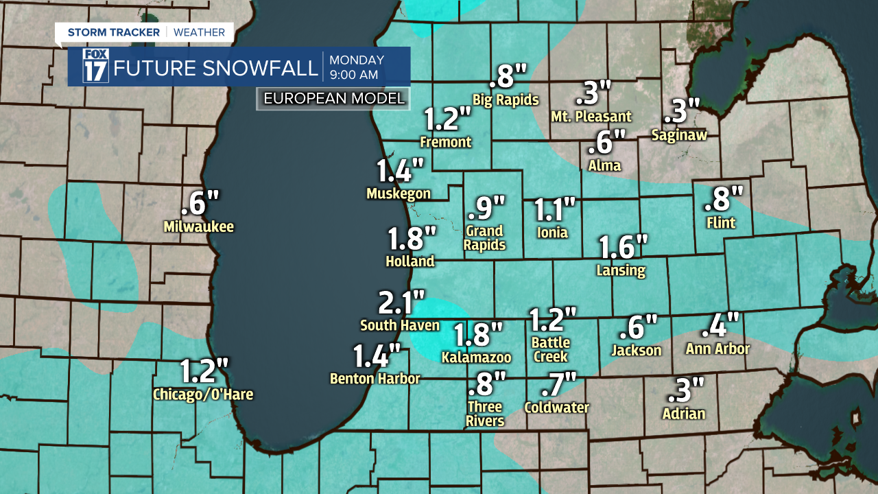
The low-pressure that is giving us the clouds and scattered snow today is weakening and heading into Canada. Until it moves far enough east, snow will only remain light and scattered with less than half of an inch expected. Once it slips into Canada, another wave will fall in line behind it. With this wave moving over Lake Michigan and having colder air to work with, lake-effect snow will expand in coverage after dark. By Sunday morning, up to an inch from the lake-effect snow will be possible, especially along the lakeshore and south of I-96.

This wave will continue to work with the colder air and extra moisture from Lake Michigan to keep the snow chances high throughout Sunday. The heaviest snow will again be along and south of I-96 on Sunday. From Sunday morning to Monday morning, another 1" to 2" of snow will be possible. A couple locations near I-94 could see up to 3 inches by the time the new week begins.
While this may not seem like a lot, it will be enough to cause some headaches out on the roads Saturday night, Sunday and Monday morning. A few of you may even have to shovel a bit!
