


A good dosage of rainfall has come down in the overnight / morning hours with 1.33" of water recorded at the airport in Grand Rapids as of the 10:53 A.M. observation. A lull in the activity is anticipated for the late morning and early to mid-afternoon period with just a rare shower around the region. Slightly better coverage of wet weather enters the picture from the southwest after 4 or 5 o'clock.
The best chance for area wide showers and thunderstorms will be between 8 P.M. this evening and 3 A.M. Sunday. Additional rainfall from this afternoon through Sunday afternoon ( additional scattered showers are predicted through the day Sunday ) is shown below. Amounts can be greater where heavy thunderstorms occur or if heavy showers focus over the same areas.
The odds of experiencing strong/severe weather for most of us is fairly low tonight but a bit of a heightened opportunity for stronger activity will be on the table to the south in the counties adjacent to Indiana. The time frame to be weather aware will be between 7 P.M. and midnight. If you live in Van Buren, Kalamazoo, Berrien, Cass, St. Joseph, and Branch counties be on the lookout for the possibility of stronger storms during this time frame. Hail and strong winds would be the threats.
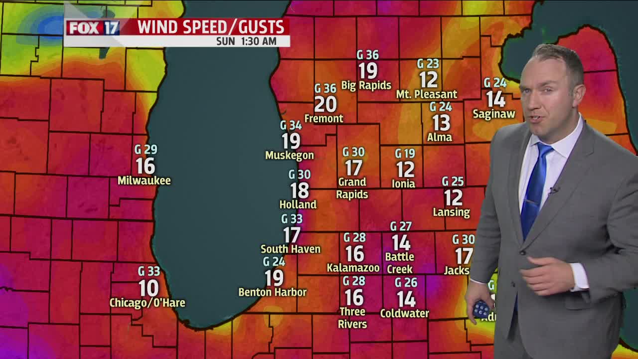
Also keep in mind the forecast continues to indicate that strong winds ( winds generated by the large scale low pressure system itself which will move from the Upper Peninsula of Michigan into eastern Ontario by early evening Sunday ) will be around for the back half of the weekend. Southwest winds will blow between 20-30 mph with gusts to 40-45 mph. A gust or two could even reach 50 mph.
It will be windy for everyone within West Michigan but the focus for the windiest conditions will be for areas just north of Grand Rapids and southward to the Indiana line. In fact, the National Weather Service has just issued a Wind Advisory for most of the day tomorrow.

Expect waves near the Lake Michigan shoreline to range from 6-11 feet. Beach erosion and localized low-lying flooding will be a possibility.
