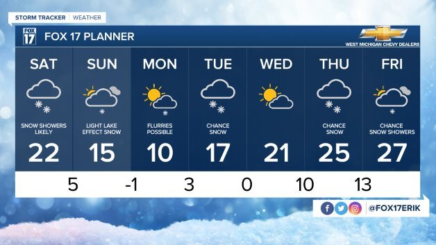
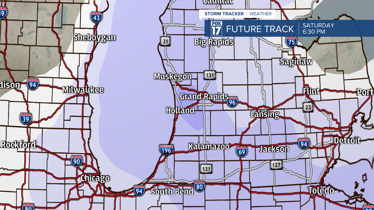
The lake-effect out there this evening will end later tonight and be replaced by widespread light snow. This snow will be from another system swinging through tonight to Saturday evening, and this one will be more organized. A widespread 1" to 3" will be provided to us by it through Saturday evening, with the heaviest amounts in the lakeshore counties. A Winter Weather Advisory is in effect for Berrien County as lake-enhanced snow with a northerly wind could bring 3" to 5" inches through Saturday evening.
If you think we are done with snow after Saturday evening, you would be wrong. Lake-effect snow will once again get going behind Saturday's system, bringing another few inches to those along and west of US-131. There is also some indications of another weak wave of snow moving in Sunday even that could bring upwards of an inch area-wide.
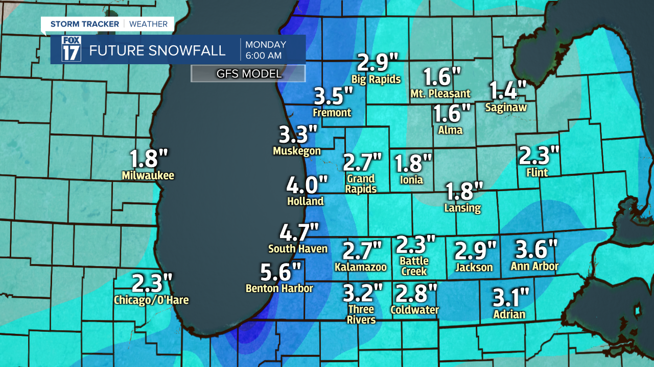
Flurries could linger around the area on Monday, but most of us will remain dry with some sunshine. Enjoy it, because accumulating snow will likely return on Tuesday.