


WEST MICHIGAN — A strong low pressure is now working its way up towards Lake Huron and Canada putting West Michigan right in the thick of strong, potentially damaging wind gusts.
Thankfully, weather models have pulled back a bit on how strong this system will get, meaning the wind gusts likely won't get too far above 50 mph. However, these winds are still strong enough to cause power outages statewide.
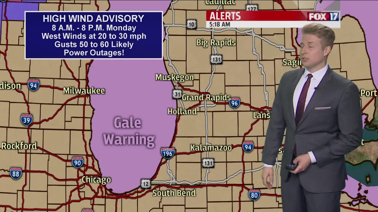
The High Wind Advisory went into effect this morning at 8 a.m. and will remain in effect until this evening. It highlights the potential of scattered power outages with wind gusts between 40 to 50 mph. There is also a Lakeshore Flood Warning with this system for the potential of flooding along the immediate lakeshore as well as significant dune and bluff erosion. Waves could be as high as 15 feet today.
The strong winds in combination with the cold temperatures will keep wind chills in the 20s as air temperatures stay consistent in the upper 30s. The heat in everyone's home, now turned office, will be cranking today thanks to this system.
Wind gusts so far this morning have already approached 40 mph but will only get worse into the afternoon. From noon to 6 p.m. is when we will see the worse of the wind up to and around 50 mph.
This system will also leave a long cold spell in West Michigan. Average high temperatures are now in the upper 50s, so we will remain 15 to 20 degrees below normal through the end of the week. Spring finally retursn this weekend and hopefully sticks around for good.
