


WEST MICHIGAN - Last week all of central and southern lower Michigan was in a "Moderate Drought". This week, that changed from NOAA and the National Weather Service upgrading parts of the area into a "Severe Drought". Right now, locations under severe drought include Ottawa, Kent, Ionia, Allegan, Barry, northern Van Buren, and southern Muskegon Counties. While our chances of rain are not zero the next few days, they are limited to just scattered showers and thunderstorms.
An upper air disturbance drifting through the Great Lakes today has generated cloud cover and a few light scattered showers and sprinkles, but we expect to be right back to mostly sunny to partly cloudy skies through the afternoon. A cold front dropping south from northern Michigan may be the focal point for scattered showers/storms Sunday afternoon/evening. That said, widespread prolonged precipitation is not expected. By Monday, a warm front lifting into the state may also be the focal point (again) for more scattered showers/storms.
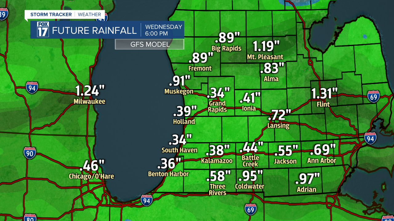
Take a look below at what our GFS Forecast Model is outputting for total rainfall through Wednesday at 6 P.M.
Unless you're lucky enough to get caught under one of these storms for a few minutes, it's unlikely most of us will see any appreciable rain, or at least enough to mitigate the drought. That means be careful doing any outside burning of brush or campfires. Get the complete West Michigan forecast at www.fox17online.com./weather.
