


WEST MICHIGAN — A larger system is developing over the United States on Monday, which is likely to bring various forms of weather over several states. States in the deep south are bracing for the potential of flooding, large hail, severe thunderstorms, strong wind gusts, and tornadoes. This includes states near the central Gulf Coast and Tennessee Valley. The states that are expected to see the strongest storms include Northeast Texas, Louisiana, Southern Mississippi, Alabama, Western Georgia, and Tennessee.
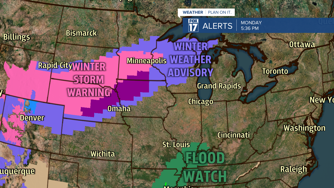
On the other hand, states in the Midwest and Great Plains are currently under Winter Storm Warnings, Winter Weather Advisories, and Ice Storm Warnings as of Monday evening. This is due to the very cold air on the back end of this system.
The National Weather Service Storm Prediction Center in Norman, Oklahoma has placed a large portion of the deep south under an outlook for severe weather on Monday and Tuesday. Below is the latest outlook for Tuesday. An Enhanced Risk, represented by the color orange, has been placed over Alabama, Mississippi, and Louisiana. This will be the zone with the greatest likelihood of flooding, large hail, strong wind gusts, and tornadoes.

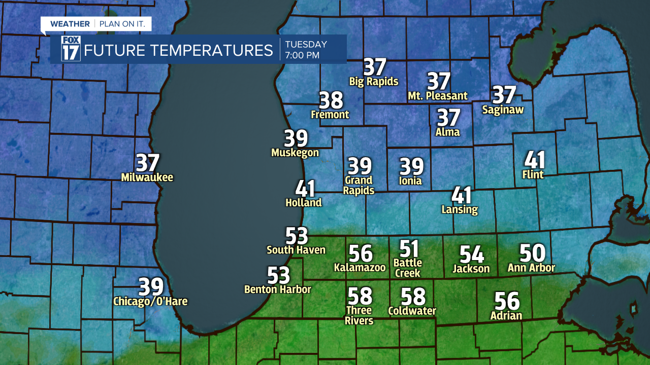
Due to the instability and warmer temperatures that are likely to surge into West Michigan, the region along and south of I-94 have the best bet at receiving a few January thunderstorms on Tuesday. The Storm Prediction Center placed West Michigan under the "thunderstorm" outlook for Tuesday. This means that severe thunderstorms are not likely in West Michigan, but a few rumbles of thunder and some heavy pockets of rain are possible. Below is a forecast model of the expected radar on Tuesday morning.

You'll notice a large temperature gradient (or difference) between Grand Rapids and Kalamazoo on Tuesday. By 7 p.m. Tuesday, locations near I-96 will be in the upper 30s while locations closer to I-94 are likely to be in the lower 50s. The warmer the temperature, the greater likelihood that you could see a January thunderstorm!
Stay tuned with FOX 17 for your latest weather alerts and extended outlook. You can always visit: www.fox17online.com/weather/.
