


We will go from near 70° to wind chills in the 20s in just a few days.
After a really nice day outside today with temperatures in the lower 60s, a warm front works it way into the area Tuesday morning. Before it moves through, heavy showers and storms are possible south of I-96 Monday night.
Once its to the north, warm air will surge into West Michigan Tuesday afternoon and evening. This will also be accompanied by a little sunshine. We need the sunshine to fuel the possibility of 70 degrees.
The best chance of hitting 70° will be along and south of I-94. This is where the warm front will be to the north of for the majority of the day and sunshine will occur the earliest.
With it being very warm, and adding somewhat humid conditions on top of it, thunderstorms could break out Tuesday evening. They will remain very scattered, but if some do develop, they will likely have heavy rain and frequent lightning.
The chance of severe weather is low, likely staying south of West Michigan. However, a strong storm is possible with gusty winds and small hail.
We get to enjoy one more warm day on Wednesday well into the 60s before a very strong cold front brings rain and dropping temperatures Wednesday night. By Thursday morning, temperatures will be in the 40s with wind chills in the 30s. Winds could gust up to 40 mph on Thursday, sending wind chills into the 20s by the end of the day.
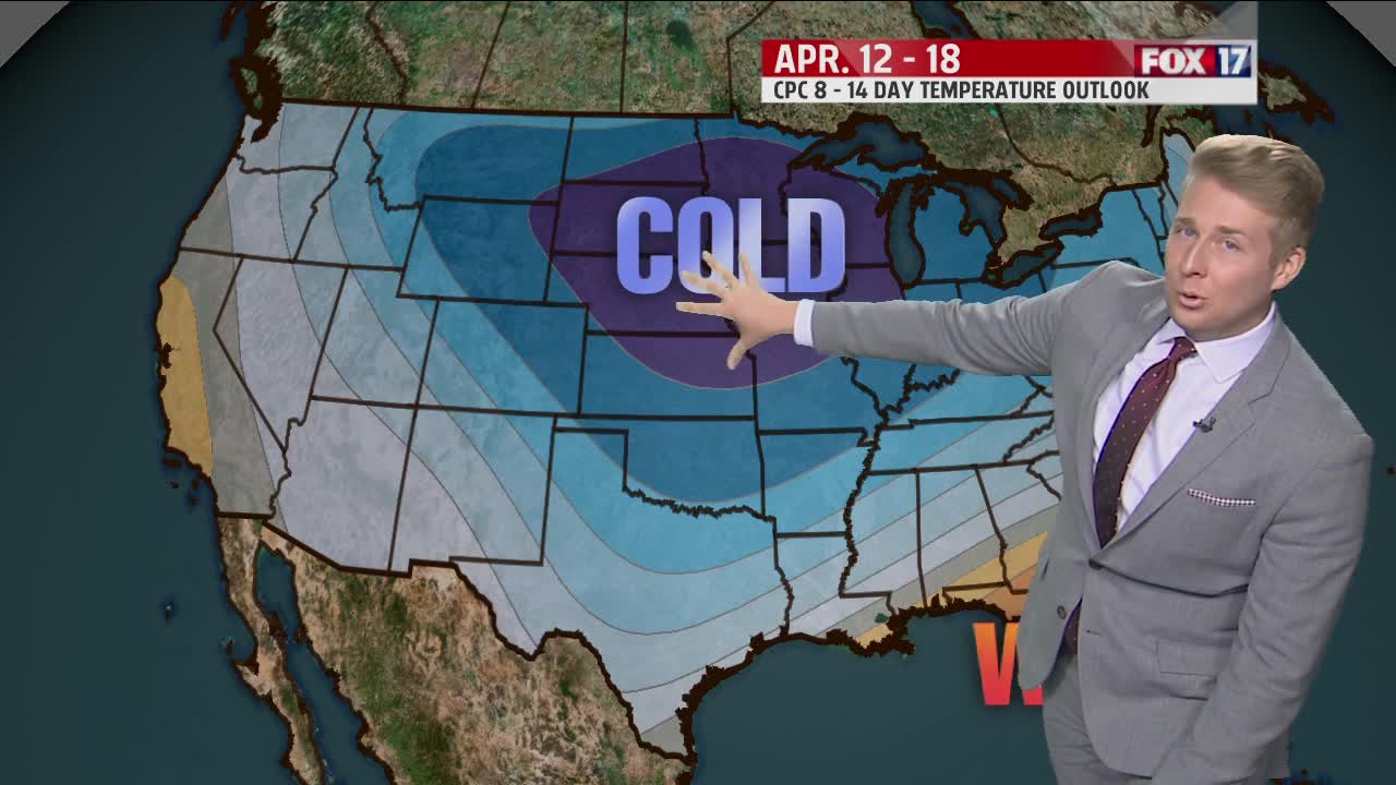
Once the cold air is here, it's here to stay. We remain below normal through the weekend and even into next week.
