


WEST MICHIGAN — March as a whole has been very quiet, with only 0.13" of precipitation and zero measureable snow up to this point. Tonight, we will flip the script as the first significant storm of the month moves in. Many spots will see ten times the March 2021 rainfall in just a few hours overnight!
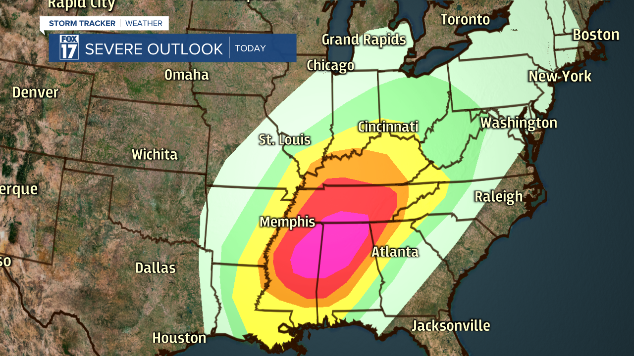
The low-pressure system will develop in the southern states today, bringing a severe weather/tornado outbreak to Mississippi, Alabama and Tennessee. This is where a high risk of severe thunderstorms is located today. If you have family or friends in these areas, make sure they are aware of the threat. The system will then move towards Detroit by Friday morning, putting West Michigan in the bullseye for heavy rain and wind.
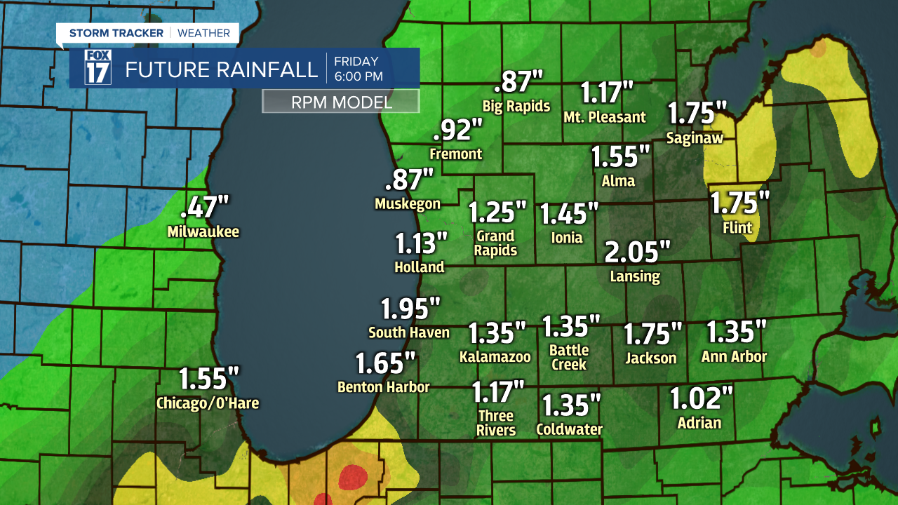
The rain will begin this evening, with the heaviest falling after sunset into Friday morning. If you live around I-69, you also have the chance of a few thunderstorms. Severe weather is not anticipated here in Michigan with this storm. Rainfall amounts will be between 1" to 2", but a few spots could see over 2" of water. While the rain is absolutely needed as lately we have been very dry, that amount of rain in a short period of time could lead to some minor flooding concerns. Ponding on the roads is likely, with a rise in local rivers and streams possible.
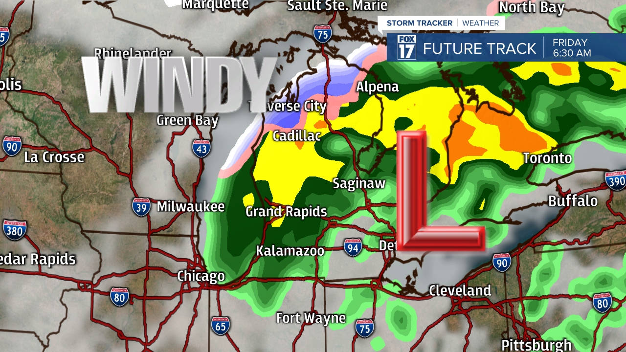
Wind will be the second issue with this storm tonight, as it will be strengthening as it moves towards Detroit. With a stronger low riding just to our southeast, we will all be in the zone of strongest winds. Sustained wind speeds of 15 to 25 mph is likely, with periodic gusts of 35 to 45 mph. Isolated power outages are possible with this level of wind.

The third issue, which will be a minor one compared to the first two, is the possibly of some snow and sleet mixing in. The risk of this is low, but nonzero. The potential will be around during the early morning hours of Friday. If the system is able to pull in enough cold air from the north before exiting, the rain could begin to mix with some snow and sleet. Even if this were to happen, little to no impacts would be felt because of it. It's just be a reminder that winter weather is still possible in March in Michigan.
The rain will end Friday morning, with some P.M. sunshine to help us dry out. Steady winds will still be around on Friday, but only sustained at 10 to 20 mph with some gusts up to 25 mph. The biggest change courtesy of this system will be the much cooler temperatures Friday, with most of us actually falling just below the normal temperature of 49 degrees.

