


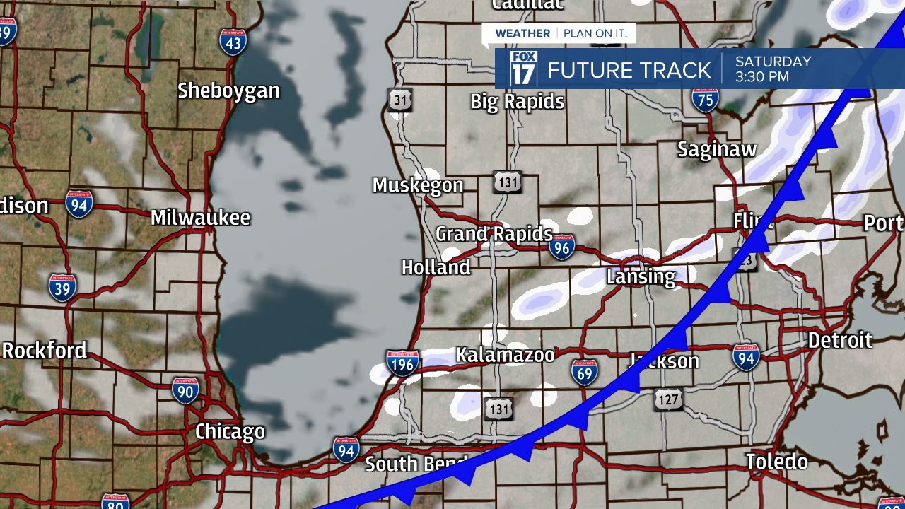
WEST MICHIGAN — Light snow showers, strong winds, and cold air are the headlines in West Michigan on Saturday. A cold front will pass Saturday morning, producing light snow showers mainly north of I-96 and along the lakeshore.

By the early afternoon hours, the cold front will shift towards the east and snow showers will weaken. Light lingering snow showers remain for the rest of Saturday, before another system moves in for Sunday.
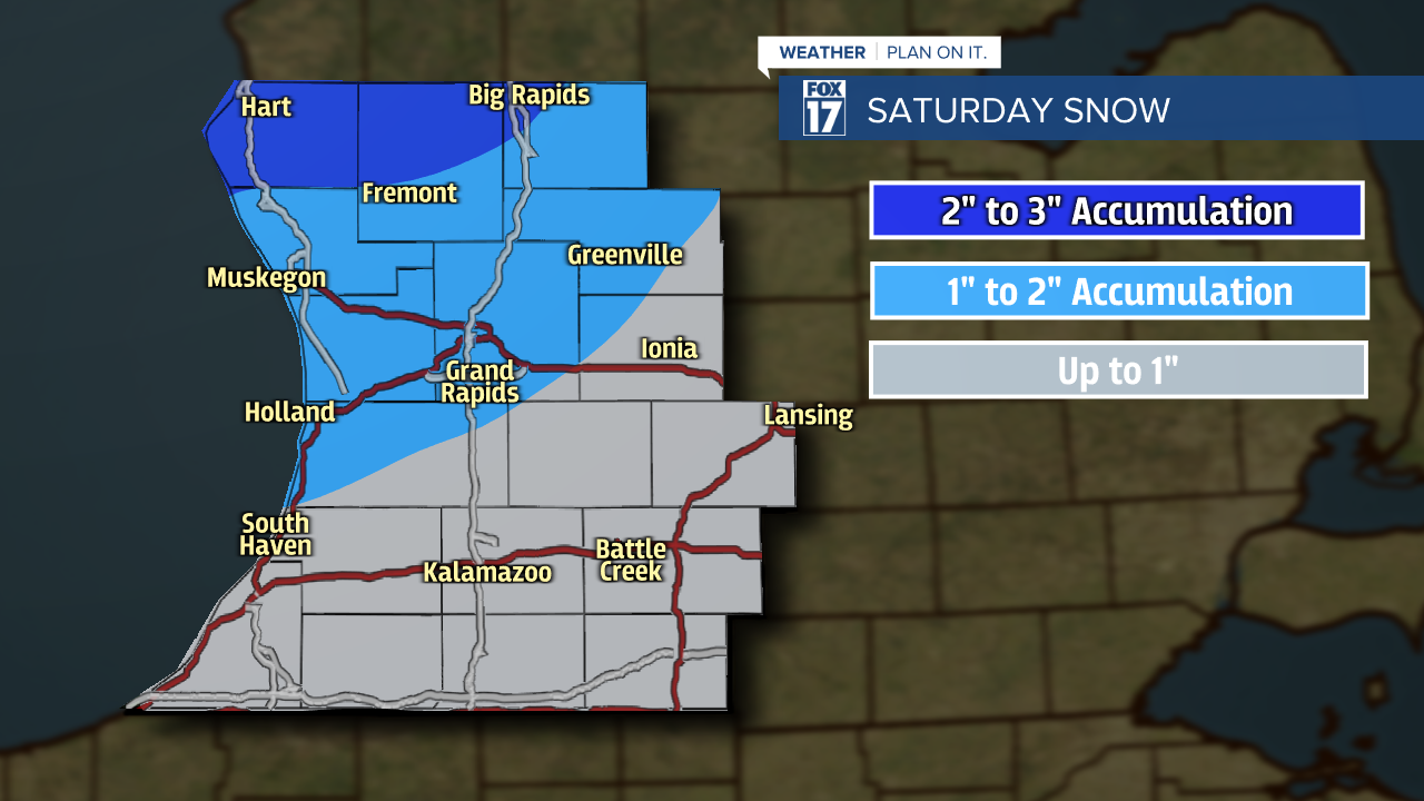
When it comes to snow totals, West Michigan is not expected to see much. However, roadways are likely to be slick! Locations closer to Big Rapids, Fremont, and Hart have the best chance of seeing up to 3 inches of snowfall. The rest of West Michigan will see about 1 to 2 inches, with only a light dusting near I-94.
In combination with the light snow showers, winds will also be strong! Steady winds from the southwest/west at 10 to 20 mph and wind gusts exceeding 30 mph will create blowing and drifting snow. Visibility will be reduced at times, additionally creating difficult travel conditions.
More snow is likely to accumulate in West Michigan on Sunday and Monday. Stay tuned to FOX 17 for updates.

