


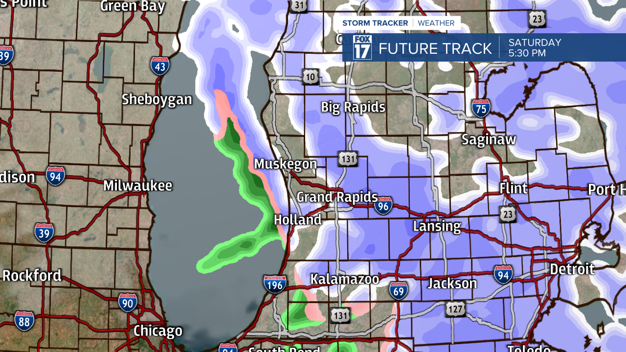
A WINTER WEATHER ADVISORY continues until 5 a.m. Sunday for Allegan, Barry, Calhoun, Ionia, Kent, Mecosta, Montcalm, Muskegon, Newaygo, Oceana and Ottawa counties. This clipper system dives southward into the region today and brings periods of light snow into West Michigan by late morning and for the afternoon and evening. Temperatures for our Saturday will stay in the 20s and 30s with breezy winds out of the south and southeast.
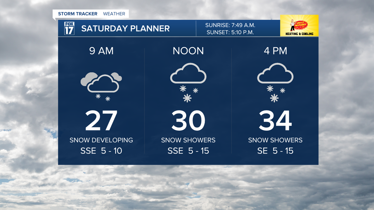
We expect 1-2" with an isolated 3” of snow with slippery and slushy roads developing throughout the afternoon. These snow showers will be more widespread in fashion becoming more scattered late this evening as we head towards the overnight hours. Be careful out on the roads!
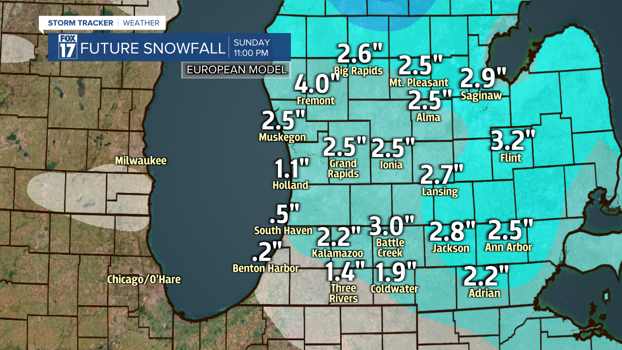
Snow shower chances turn more lake effect style on Sunday where we could gain another inch of snowfall. Monday we have our third round of snow with a bit of a wintry mix possible as well in a scattered fashion throughout the day. When there is dry time plan on mostly cloudy conditions with temperatures in the 30s through the weekend and early next week.

