
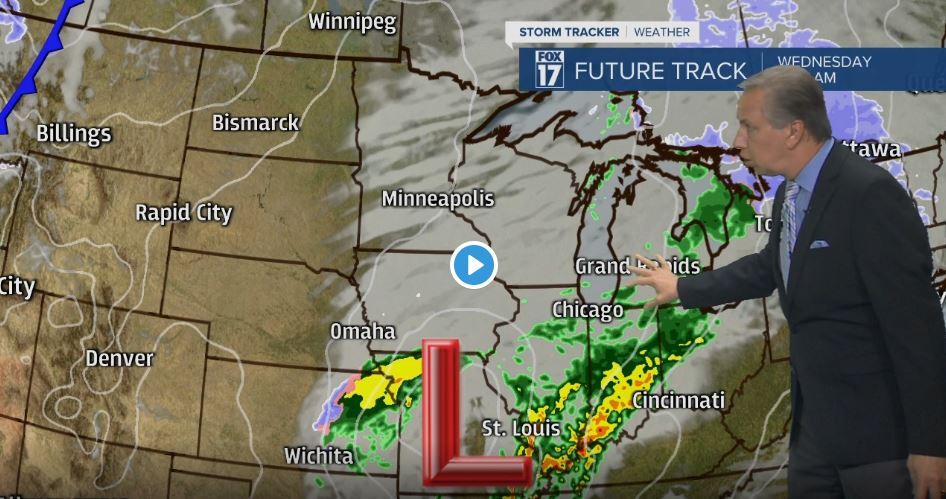


WEST MICHIGAN — The forecast from FOX 17 Chief Meteorologist Kevin Craig: WINTER WEATHER ADVISORIES have been posted for our northern counties of Oceana, Newaygo, and Mecosta with 2" to 4" of snow on both grassy surfaces and roadways. Slippery conditions have been noted in these locations already. All snow showers transition to light rain and drizzle overnight as warmer air lifts into the state overnight. Temperatures on Wednesday will push into the mid/upper 40s with off/on rain showers and/or drizzle likely. Thanksgiving looks dry and mostly cloudy with highs in the upper 40s. Sharply colder temperatures with lake effect snow are possible for the beginning of next week.
TONIGHT: Cloudy with light rain, drizzle, and areas of fog. Lows in the mid/upper 30s early, then slowly rising into the lower 40s by daybreak. Winds southeast at 5 to 15 mph.
WEDNESDAY: Off/on rain showers and/or drizzle likely. A bit warmer too. Steadier rain occurs in the afternoon and evening. Highs in the mid/upper 40s. Winds east-southeast at 5 to 10 mph.
THANKSGIVING: Mostly cloudy, quiet, and mild. Highs in the upper 40s to near 50. Winds west-southwest at 5 to 15 mph.
FRIDAY: Partly cloudy to partly sunny and dry. Highs in the mid to upper 40s.
